Subject: Northern Asia
Period: 1612-1729 (circa)
Publication:
Color: Hand Color
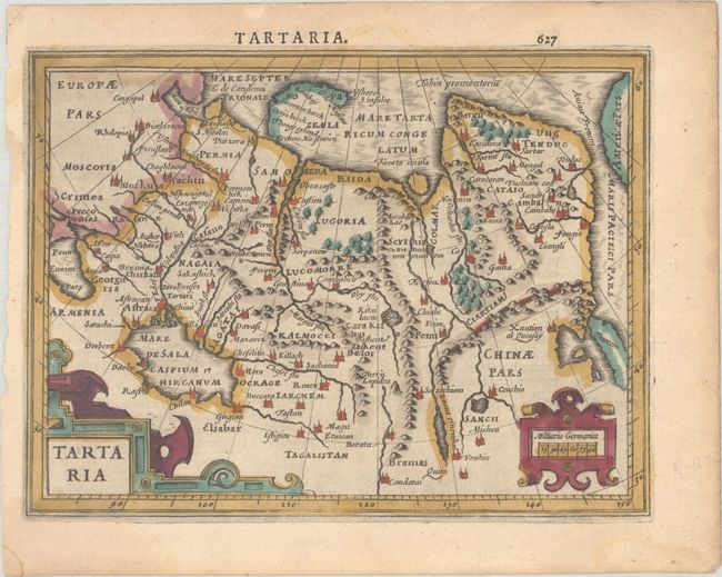
A. Tartaria, by Mercator/Hondius, from Atlas Minor, circa 1610 (7.4 x 5.6"). This handsome small map depicts the northern region of Asia fully engraved with mountains, forests, and towns. It includes part of China and the island form of Korea. The Anian Fretium separates Asia from Americae Pars. The map features strapwork title and scale of miles cartouches. Latin text on verso, published between 1610-1621. References: Moreland & Bannister, p. 98; Van der Krogt (Vol. III) #8050:351. Condition: On watermarked paper with light dampstaining along the edges of the sheet that barely enters map image. Remnants of hinge tape on verso.
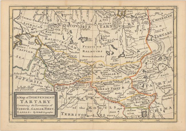
B. A Map of Independent Tartary Containing the Territories of Usbeck, Gascar, Tibet, Lassa &c., by Herman Moll, circa 1723 (10.1 x 6.9"). This uncommon small map covers the region from the Caspian Sea to the Great Wall of China. The region is mostly the domain of the Kalmyk people with various areas denoted for Black Kalmucks, Fugitive Kalmucks, Brown Kalmucks, etc. Other kingdoms include the Usbeck, Gasgar, Great Tibet, and Lassa or Boutan. The map was first published in Atlas Geographicus. "Printed for Carington Bowles in London." Reference: cf. McCorkle (18th C. Geography Books) #9, Vol III [12]; cf. Shirley (BL Atlases) T.MOLL-3a #66. Condition: A sharp impression with contemporary outline color on a sheet with a large coat of arms watermark and minor toning along centerfold and sheet's edges.
References:
Condition: A
See description above.