Subject: Southeast China, Guangzhou
Period: 1754 (circa)
Publication: Histoire Generale des Voyages...
Color: Hand Color
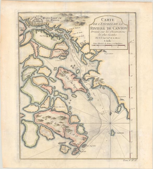
A. Carte de l'Entree de la Riviere de Canton Dressee sur les Observations les Plus Recentes, (8.1 x 10.1"). This copper engraved map centers on the mouth of the Canton River with the island of Macao and the future site of Hong Kong, here called Sinn-gan-hien. The fortified city of Canton is divided into Tartar and Chinese districts. Soundings and anchorages are shown and the map is decorated with a cartouche, rhumb lines, and fleur-de-lis. "Tom. V. No. 16" at lower right outside neatline. Condition: Issued folding, now flat, with light damp staining. A binding trim in the bottom right margin has been replaced with archival materials.
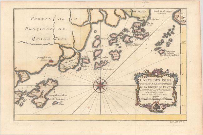
B. Carte des Isles qui sont a l'Embouchure de la Riviere de Canton Dressee sur les Observations des Navigateurs, (12.6 x 8.1"). This attractive map shows nice detail of the islands off the coast of Southeastern China, including Macao. There are numerous soundings noted with a large compass rose, rhumb lines, and a decorative cartouche. "Tom. VI. No. 7" at lower right outside neatline. Condition: Issued folding on a sheet with a bunch of grapes watermark. There is minor toning, a small spot below the compass rose, and marginal toning.
References:
Condition: B+
See description above.