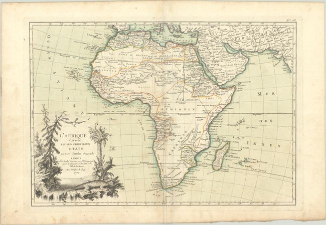
Subject: Africa
Period: 1762 (published)
Publication: Atlas Moderne
Color: Hand Color
Size:
17.2 x 11.9 inches
43.7 x 30.2 cm
This excellent copper engraved map of the continent shows the extent of European geographical knowledge in the mid 18th century. While mostly accurate, it does have remnants of fantasy such as the twin lake source of the Nile in the Mts de la Lune, which in this depiction is quite a bit north of the Equator. C. de Bonne Esperance and Stellembos Pic are the only settlements marked in southern Africa, which is occupied by the Hottentots tribes. The pictorial title cartouche features a waterfall, pine trees, a leopard, and a crocodile.
References: Norwich #104.
Condition: B+
A crisp impression with contemporary color on a sheet with the watermark of a Maltese cross encircled by rosary beads. There is light soiling, two tiny worm holes in the image, and two short worm tracks in the bottom margin.