Subject: Western Hemisphere - America
Period: 1763 (dated)
Publication:
Color: Hand Color
Size:
24.3 x 19.5 inches
61.7 x 49.5 cm
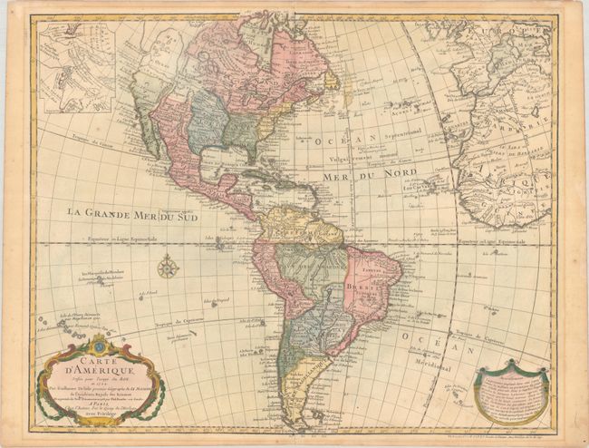
This map was originally issued by Guillaume Delisle in 1722 and was one of the most popular maps of the 18th Century with numerous editions. This is the important seventh state of the map, notable because it depicts the mythical Sea of the West. The huge inland sea dominates the Pacific Northwest and a large inset illustrates Buache's elaborate Northwest Passage theories including a conjectural Lac de Valasco. In Labrador another hypothetical inland sea, Mer Nouvellement Decouverte makes an appearance. In South America, Brazil is separated from the Pays des Amazones. A garland draped title cartouche, 'Avertissement' cartouche, and compass rose decorate the map. Philippe Buache's imprint is in both the title cartouche (with the date 1763) and at bottom right (with the date 1745).
References: Tooley (America) #7, pg. 14; McGuirk #111; Wagner (NW) #523.
Condition: B+
On watermarked paper with light dampstaining at right, a few spots of foxing, and a short archivally repaired centerfold separation at bottom. There is light mat burn in the blank margins from a previous framing.