Subject: Western Africa
Period: 1683 (circa)
Publication: Zee-Fakkel, Part V
Color: Hand Color
Size:
22.9 x 19.8 inches
58.2 x 50.3 cm
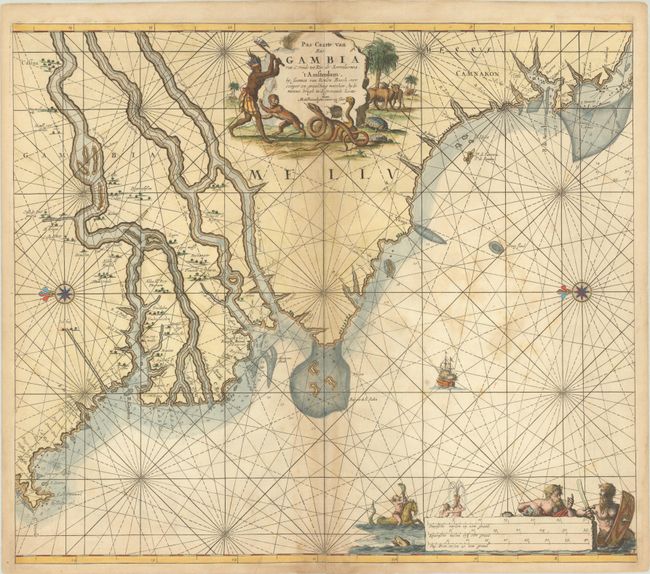
This elegantly engraved and very decorative sea chart covers the coast of Western Africa from the mouth of the Gambia River south to the Sierra Leone River. The chart is crisscrossed by rhumb lines and is full of navigational information. A compass rose capped with a fleur-de-lis orients north to the left. Inland information is sparse except for place names along the banks of the various rivers depicted. Neptune, Triton, a hippocampus, and other allegorical figures appear around the distance scales at bottom. The striking title cartouche features a native figure raising an ax and a monkey fleeing a pair of snakes. This is the first state, before insets of Goree and Tagrin Bay were added.
References: Koeman, Keu 123 A #3.
Condition: B
A crisp impression with archivally repaired centerfold separations at top and bottom. There are scattered dampstains that are primarily visible in the ocean at right and along the centerfold.