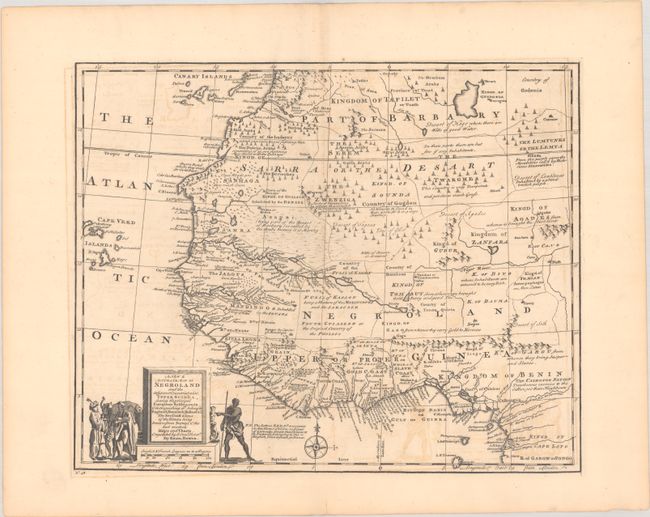
Subject: Western Africa
Period: 1747 (circa)
Publication: A Complete System of Geography…
Color: Black & White
Size:
16.8 x 13.6 inches
42.7 x 34.5 cm
This terrific map of West Africa is filled with interesting notations concerning tribes and geographical features, such as, "Kingd[om] of Temian Antropohages or Men Eaters," "Desart of Lumptunes Inhabited by a proud brutish people," and "Country of the Ludayes which can raise 80,000 fighting Men." The coast of Guinea is labeled Grain, Tooth, Gold, and Slave Coasts, with the locations of the factories belonging to the English, French, Dutch, and Danish. The title cartouche sits on the distance scale, which is in French and English leagues. Flanking the cartouche are costumed Africans, an elephant, and monkeys.
References: McCorkle (18th c. Geography Books) #17-18 (Vol II); Norwich #322; Shirley (BL Atlases) T.BOW-2a #48.
Condition: B+
A dark impression on a sheet with "IV" and a large fleur-de-lis coat of arms. There is light offsetting and a couple short edge tears in the blank margins.