Subject: Central Africa
Period: 1650 (circa)
Publication:
Color: Hand Color
Size:
7.3 x 5.1 inches
18.5 x 13 cm
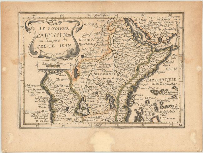
This scarce small map was copied from Jansson's plate for his Atlas Minor. The legendary kingdom of the Christian Prester John is the central focus of this small map of central Africa. It is based on the reports of the Portuguese explorer, Francisco Alveres, who searched for the mythical kingdom in the year 1520. The kingdom itself is shown atop the Amara M (near the middle of the map). The Nile is shown with its source in the Ptolemaic twin lakes of Zaire and Zaflan, at the foot of the Mountains of the Moon (Luna M.). This French map was first published by Jean Boisseau in 1643 and issued here by Picart.
References:
Condition: B+
Contemporary outline color with two small stains along the side borders and minor toning mostly in the margins. Several worm holes and tracks in the blank margins have been professionally infilled.