Subject: South Pacific Ocean, Australia
Period: 1802 (dated)
Publication:
Color: Hand Color
Size:
23.6 x 18.7 inches
59.9 x 47.5 cm
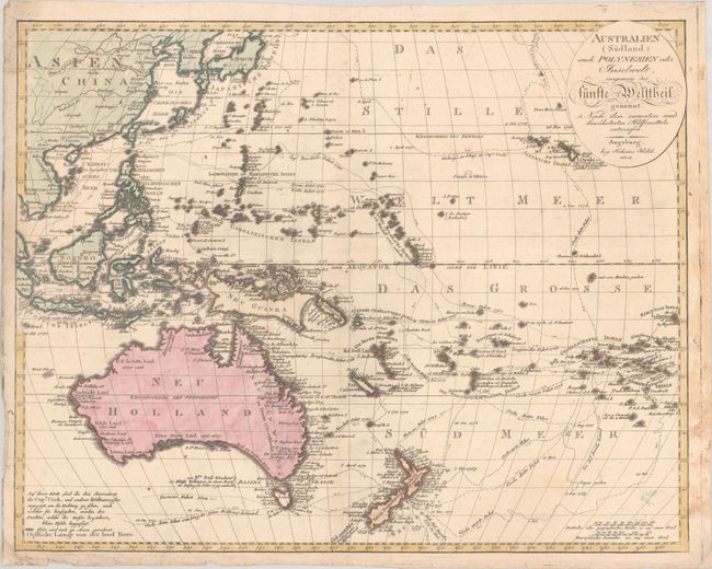
This German map of the South Pacific Ocean features the tracks of numerous explorers, including Cook, Tasman, Marshall, Byron, Wallace, Bougainville, and more. There is excellent detail of place names along the coastline of Australia and New Zealand, and numerous tiny islands are named as far east as French Polynesia. New Zealand is labeled by its Maori names. New Guinea is still presented in a very rudimentary shape. This is the first edition; the map was revised and republished in 1820, 1824, and 1826.
References: Tooley (Australia) #1309.
Condition: B+
There is dampstaining that just enters the map image at right and light extraneous creasing, mostly at bottom left. The right edge has been reinforced with old paper on verso.