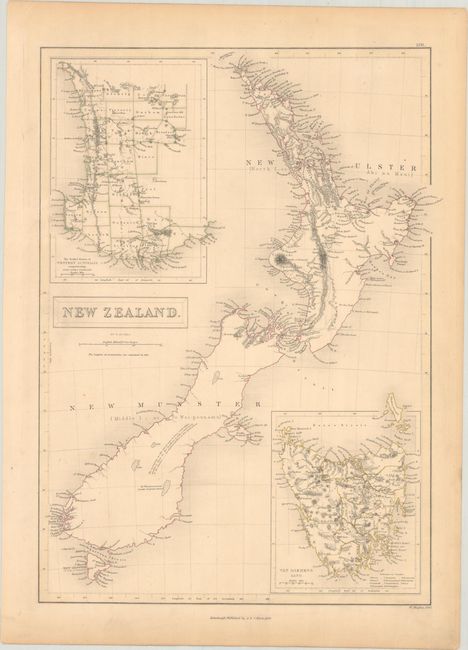
Subject: New Zealand
Period: 1843 (dated)
Publication: Black's General Atlas
Color: Hand Color
Size:
10.9 x 15.1 inches
27.7 x 38.4 cm
This delicately engraved chart shows both major islands, here called New Ulster (North I., or Ahi na Maui) and New Munster (Middle I., or Te Wai-pounamu), in good detail, particularly along their coastlines. A note within New Munster reads, "The mountains in this island seem to form coast-ridges, similar to those in the Northern I., with a table-land in the interior," followed by reference information. Insets detail The Settled Portion of Western Australia and Van Diemens Land, and locate the counties, towns and cities, rivers, lakes, and mountains of these areas. Drawn and engraved by W. Hughes.
References:
Condition: A
Contemporary outline color on a slightly toned sheet with a couple tiny edge tears confined to the bottom blank margin.