Subject: Atlases
Period: 1624 (published)
Publication:
Color: Black & White
Size:
12.8 x 18.6 inches
32.5 x 47.2 cm
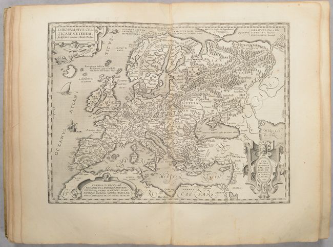
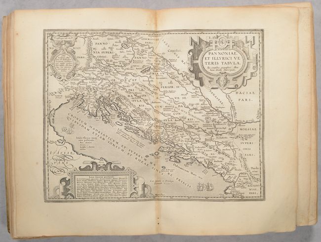
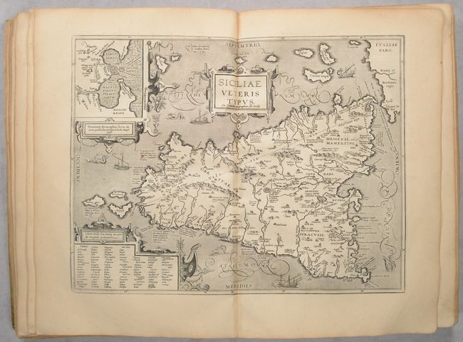
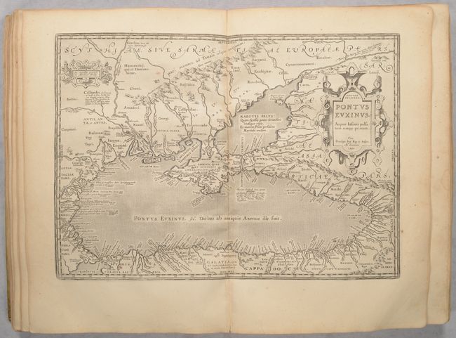
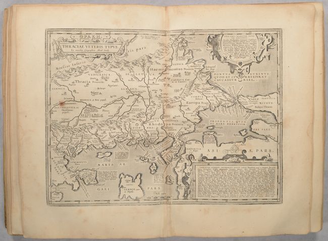
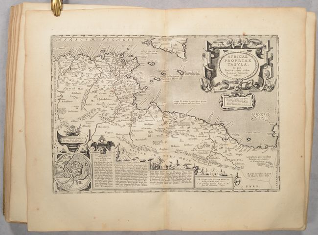
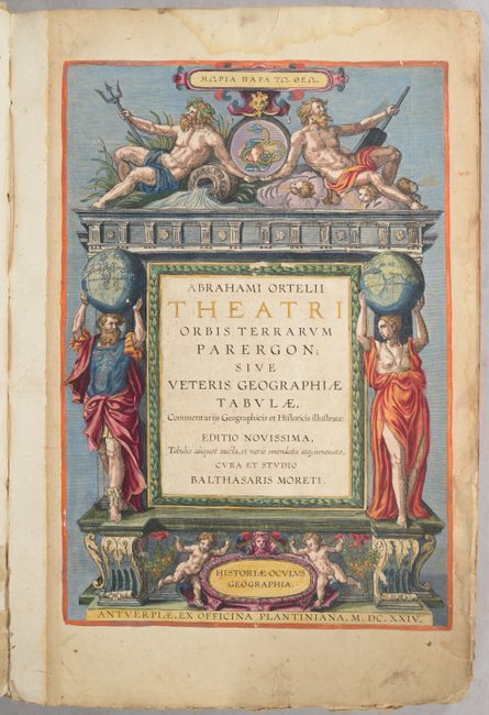
This is a complete example of the final edition of Ortelius' great atlas of ancient geography. The Parergon began appearing as a small supplement in the 1579 editions of Ortelius' Theatrum with just three maps of the ancient world. Over time, the map count grew and by 1591, the Parergon had 26 plates. By this final 1624 Latin edition, the map count had grown to 44 and was published as a separate book by Balthasar Moretus in Antwerp. Unlike the maps in Theatrum in which Ortelius copied other maps, the Parergon is a completely original work and a project that Ortelius took great care in executing. Koeman remarked that "the maps and plates in the Parergon have to be evaluated as the most outstanding engravings depicting the wide-spread interest in classical geography in the 16th century." Some of the notable maps include:
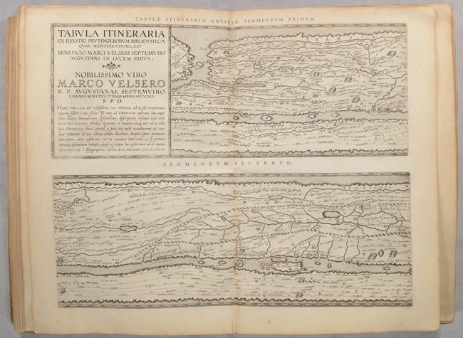
[On 4 Sheets] Tabula Itineraria ex Illustri Peutingerorum Bibliotheca quae Augustae Vindel... These four sheets are Ortelius' scarce version of the famous Peutinger Table. These decorative maps, in a sequence of four plates, each with two strip maps, depict the imperial roads and posts within the Roman Empire throughout Europe, North Africa and Asia as far as Toprobana (Sri Lanka). The format distorts the landmasses, but provides an excellent view of the cities and roads, which include distances between the posts. The three most important cities of the Roman Empire, Rome, Constantinople and Antioch, are represented by enlarged symbols including the emperor seated on a throne. The original parchment document for this incredible map is thought to have been made in the thirteenth century. The original now resides in the Vienna National Library, but is so damaged that the Ortelius version is now the most reliable representation.
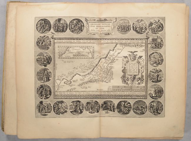
Abrahami Patriarchae Peregrinatio, et Vita. This beautiful Holy Land map details the wanderings and life of the Patriarch Abraham. The map is displayed as though on a banner hung on a wall; it shows Palestine and a portion of Egypt, inset with a small map of the Middle East from the Mediterranean to the Euphrates River. The imaginative design includes an elaborately engraved frame containing twenty-two scenes illustrating the life of Abraham, spanning his departure from Ur to his death. This is from the second plate, used from 1590-1624, with the hachuring within the medallion border running from upper left to lower right.
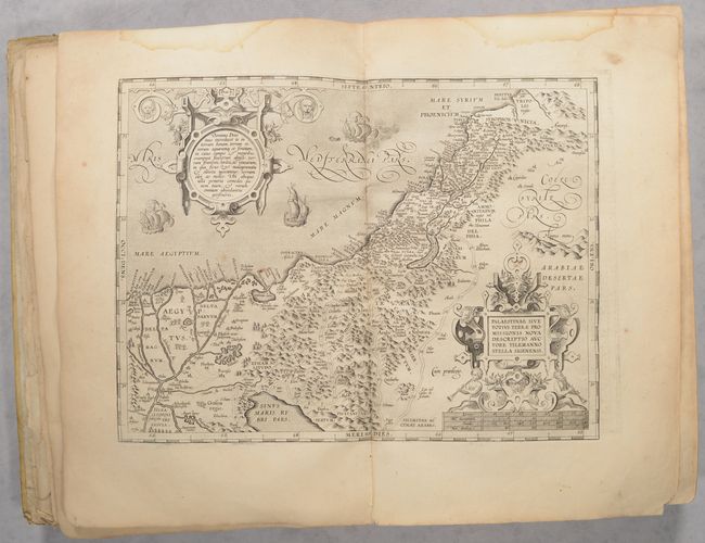
Palestinae sive Totius Terrae Promissionis Nova Descriptio Auctore Tilemanno Stella Sigenens. This map of the Holy Land covers the region from the Nile Delta to Lebanon, and focuses on the desert of the Exodus. Ortelius' map was based on Tilemanno Stella's map of 1557 that became the prototype for the modern cartography of the Holy Land. Stella adapted the coastline and Dead Sea from the configuration of Jacob Ziegler's map of 1532. But here, Ortelius rounds Stella's angular Dead Sea and the Gulf of Aqaba. The map is richly decorated with two elaborate, neoclassical cartouches.
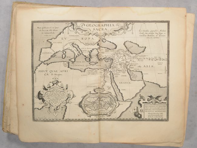
Geographia Sacra. This map depicts the world known to the ancients and is based on the Old and New Testament, following the translation of the Septuaginata. Inset into the map is a small (4 x 2.5") modern world map on an oval projection. The cartouche contains text describing Ophir, the mythical land where Solomon got the gold to build his famous temple in Jerusalem. The small world map shows the mythical Ophir in four possible locations; Southeast Asia, South Africa, the West Indies and South America.
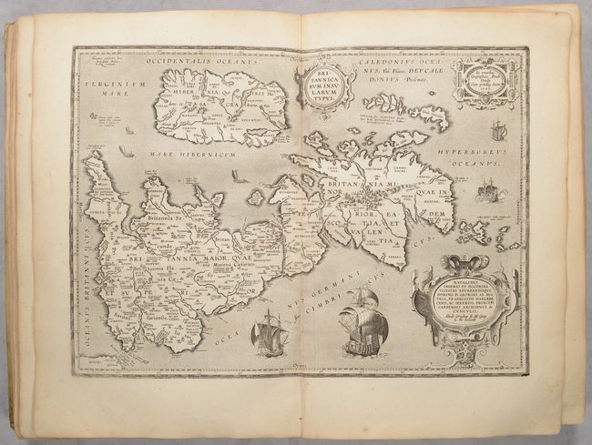
Britannicarum Insularum Typus. This handsome map of Roman Britain is based on information from Mercator's 1564 map of the British Isles, a new outline from Saxton's 1579 map, and ancient knowledge from Diodorus, Siculus, Plinius, Appianus, Tacitus, Caesar, and Strabo. The map is filled with ancient place names, and Hadrian's Wall and Wall of Pius (mislabeled Severi Imp. Murus) are located. Richly embellished with three large strapwork cartouches and several sailing vessels.
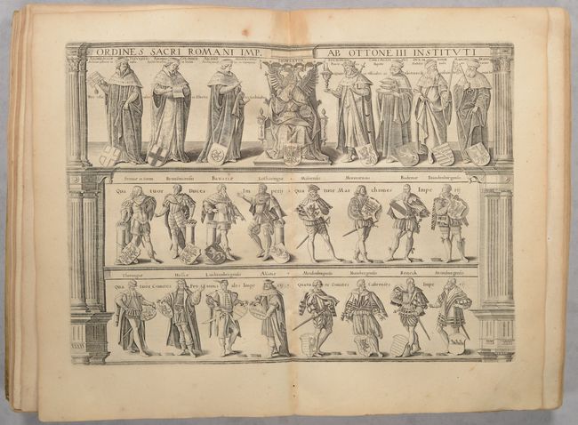
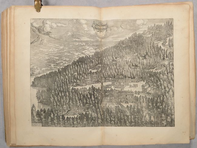
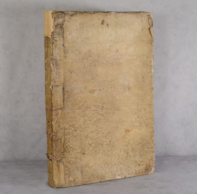
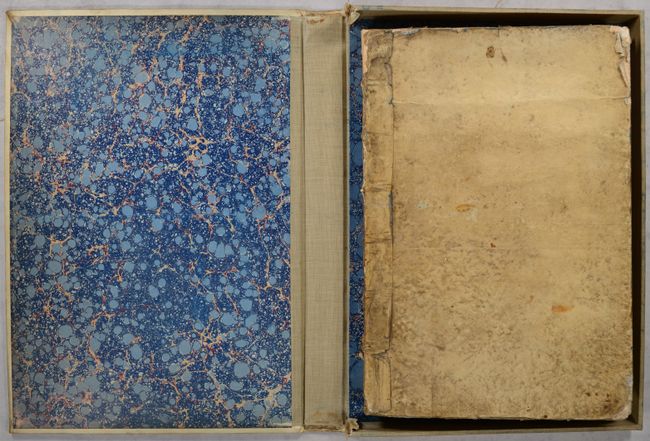
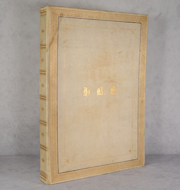
Also of interest in the atlas are views of Tempe, Greece and Antioch, Turkey, as well as two plates of costumed figures. Following the maps is the Nomenclator Ptolemaicus, a comprehensive listing of ancient place names seen in the atlas. Title page is hand-colored and all other plates are black & white. Hardbound in contemporary vellum with some rebacking. Housed in a modern monogramed vellum case.
References: Koeman (Vol. 3) Ort #46; Van der Krogt (Vol. III) #31:711.
Condition: B+
Overall sharp impression on clean bright sheets, with 29 maps in A condition, 13 maps in B+ condition, and 2 maps in B condition. The maps were re-guarded at some point with some light stiffness along the gutter throughout. Occasional imperfections include occasional light toning, minor printer's ink residue, and creasing along the centerfold. The map of France has a short tear at top that extends 1.75" into the image, and the first seven maps have some light dampstaining confined to the top blank margin. The first three sheets (title page, dedication and publisher's note) are detached and the Nomenclator Ptolemaicus at the rear is somewhat loose. There is a large chip at the bottom of the front free endpaper and the title page has some roughness and dampstains along the edges. Hinges are starting. Contemporary binding was partially rebacked with some other old repairs to spine. Covers are soiled, heavily worn along the edges, and the front cover is bowed. Housed in a modern vellum case.