Subject: Atlases
Period: 1762 (circa)
Publication:
Color: Hand Color
Size:
2.9 x 4.4 inches
7.4 x 11.2 cm
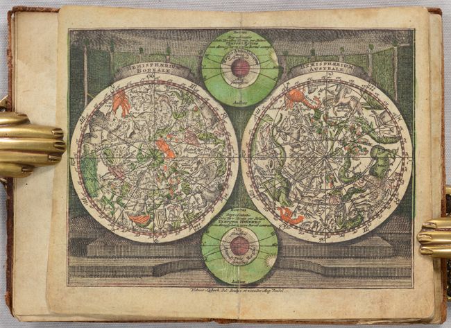
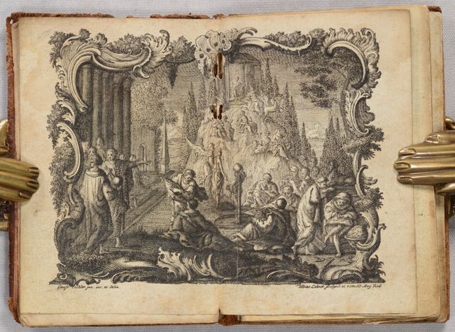
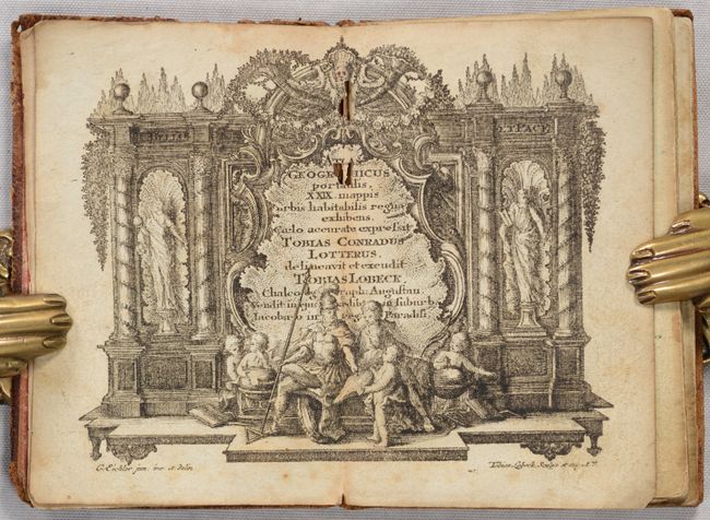
A nice pocket atlas with decorative maps in full contemporary color. It opens with a title page in an architectural cartouche, followed by an allegorical frontispiece, both drawn by Gottfried Eichler, junior. The maps include the celestial and terrestrial hemispheres, the continents, and detailed maps of western and eastern Europe. Most maps are embellished with a fine title cartouche. This atlas was a collaborative publication between Tobias Conrad Lotter and Tobias Lobeck, first published as an almanac in 1745 with six maps. By 1747, it grew into atlas form with 29 maps. The atlas continued to remain in use for many years, with the maps reprinted and with new maps added, but the title page continued to report 29 maps. The maps present in this example are:
1) Hemisphaerium Boreali [and] Hemisphaeriusm Australe
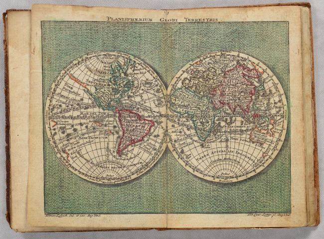
2) Planisphaerium Globi Terrestris
3) Europa
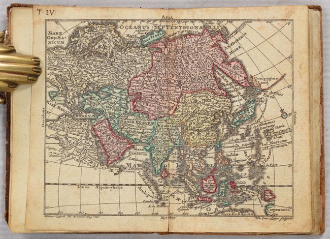
4) Asia
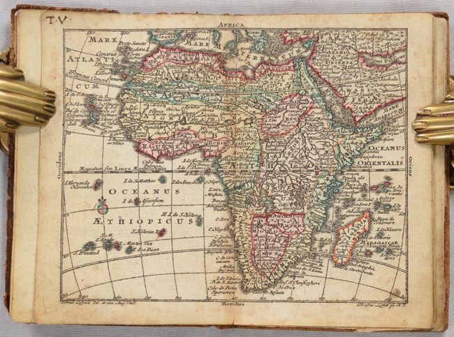
5) Africa
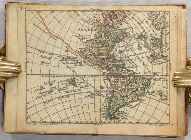
6) America
7) Regnorum Hispaniae et Portugalliae Tabula Generalis
8) Totius Regn. Galliae sive Franciae Tabula
9) Nova Totius Italiae cum adjacentibus Maroribus et Minoribus Insulis
10) Republic di Genova
11) Status Ecclesiastici Magni que Ducatus Florentini Tabula
12) Magna Britannia complectens Angliae, Scotiae, et Hiberniae Regna
13) Tabula Gener. Totius Belgii qua Provinciae XVII Infer. Germaniae olim sub S.R.I. Circula Burgundiae
14) Germania Inferior
15) Potentissimae Helvetiorum Reipublicae Cantones Tredecim
16) Germania H. Romische Reich...
17) Cercle d'Autriche
18) Cercles de Baviere, de Suabe, de Franconie…
19) Vereinigte Niederlande, Spanische Niederlande, Herzogt. Brabant, Herzogt. Luxemburg, Graefsch. Flandern
20) Cercle de Saxonie…
21) Boheme, Morovia, & Saxonie, Lusace, Silesie…
22) Ducatus Mediolani
23) Ducatus Sabaudiae
24) Bohemiae Regnum…
25) Poloniae Regnum…
26) Borussiae Regnum cum Adjacentibus Regionibus
27) Regnum Daniae
28) Regnum Sueciae
29) Impericum Russicum Omnisque Tartaria
30) Regni Hungariae Tabula Generalis
31) Tabula Dunabii Graeciae et Archipelagi.
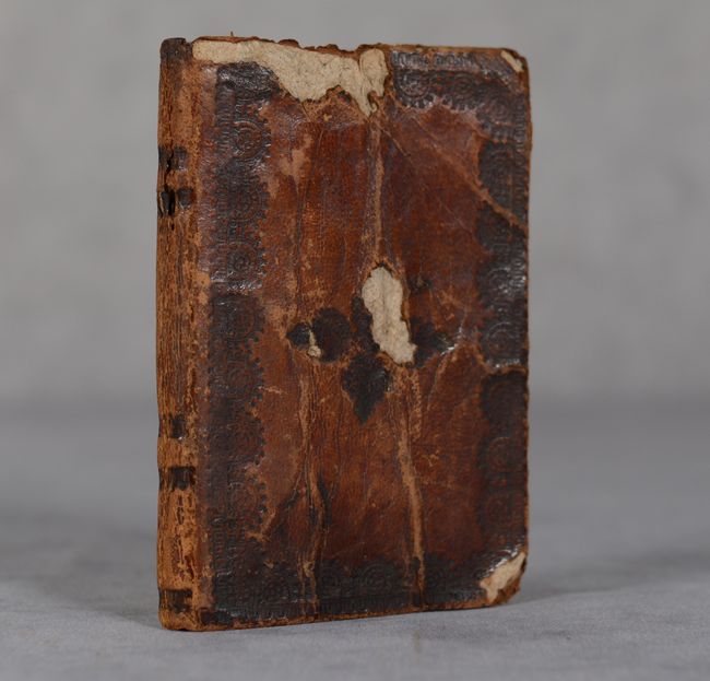
Following the maps is the list of maps, "Index Mapparum Geograhicarum," which lists the 29 maps. The atlas' collation does not, as often found, exactly match the list given on the Index. Full contemporary leather binding.
References: King (3rd Edition) 1744 Lobeck; cf. Mickwitz & Miekkavaara #134.
Condition: B
The maps are in full contemporary color with minor foxing, light toning primarily along the centerfold, and some faint dampstains in the corners and along the gutter. The title page and allegorical frontispiece have a few wormholes along the upper centerfold. Binding is very loose but maps are still intact. Front cover is creased and with a couple of gouges.