Subject: School Atlases
Period: 1836 (published)
Publication:
Color: Hand Color
Size:
9.3 x 11.5 inches
23.6 x 29.2 cm
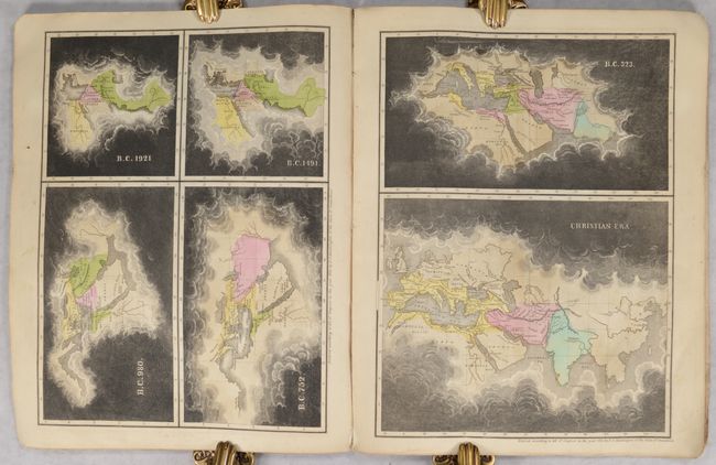
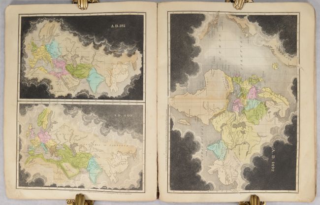
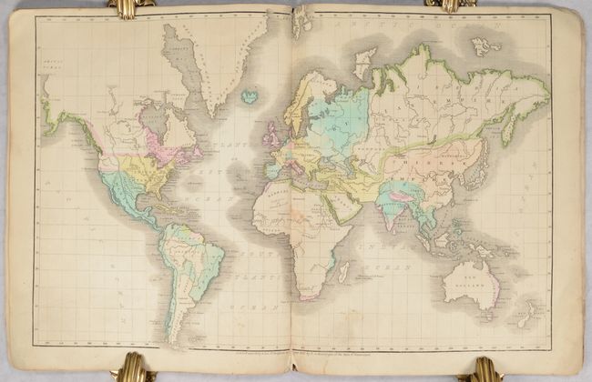
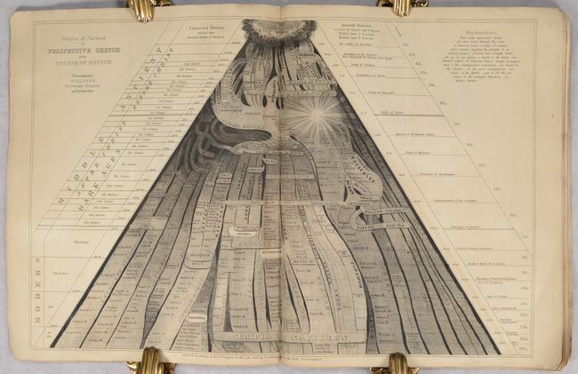
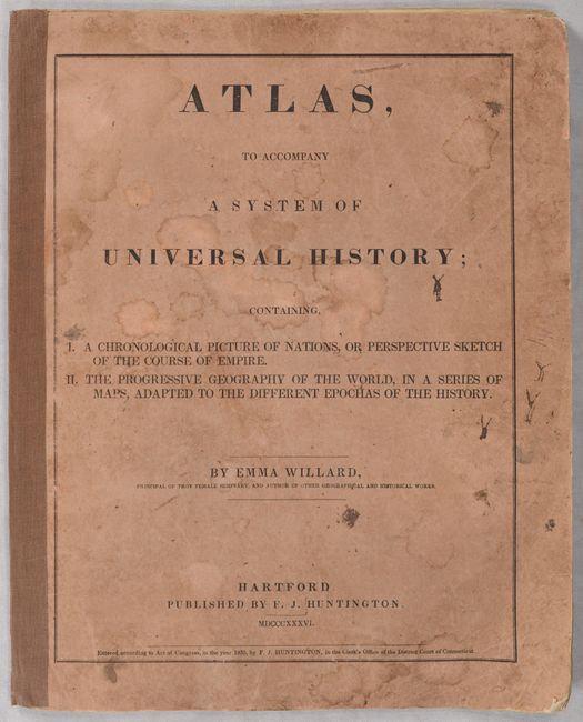
This small atlas accompanied Willard's System of Universal History (not present) and contains a double-page map of the modern world, 4 single-page map sheets showing the known world, and a "Picture of Nations or Perspective Sketch of the Course of Empire." Of particular interest are the 4 sheets showing the known world at 9 different periods of time from 1921 B.C. to 1492. Each period is represented by a map with areas that were unknown at that time covered in a layer of dark clouds. Over time, as knowledge of the world increased, the dark clouds on the maps get pushed further and further out. The final map, dated 1492, shows the world prior to the discovery of America. This map concept was introduced in 1830 by Edward Quin in his An Historical Atlas; in a Series of Maps of the World as Known at Different Periods. The double-page world map shows the United States extending to the Rocky Mountains, a blank Pacific Northwest, and a named Texas under Mexican control.
Emma Willard was an education activist who founded the first school for women's higher education, the Troy Female Seminary, in 1814. Due to the school's success, Willard was able to travel across the globe advocating women's education. The school still operates today, having been renamed the Emma Willard School in 1895. Published by F.J. Huntington in Hartford, Connecticut. Rebacked with original printed paper boards.
References: Rumsey #4545.
Condition: B+
The contents are very good with a bit of light toning and soiling. Covers have some soiling and dampstaining. Spine has been replaced with binder's tape.