Subject: Colonial North America
Period: 1706 (circa)
Publication: Les Tablettes Guerrieres…
Color: Hand Color
Size:
7.4 x 5.4 inches
18.8 x 13.7 cm
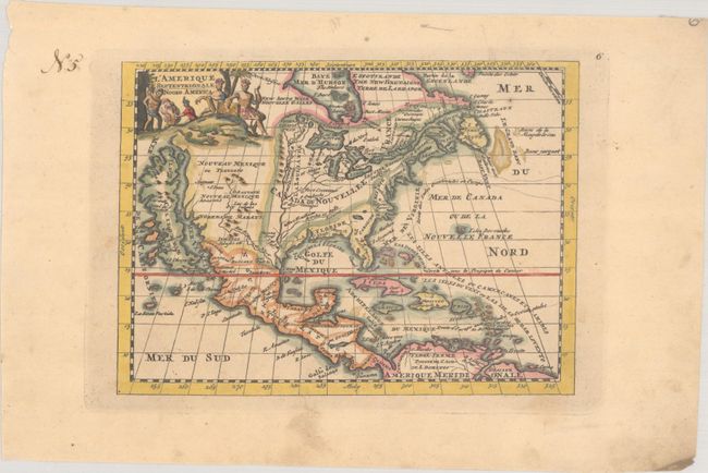
This charming small map features a huge island of California with an indented coastline and the place names R. d' Estiete, C. Blanco, P. de Carinde, Canal de S. Barbe, I. de S. Martin, I. de S. Mare, B. de S. Francisco, B. de Simon, B.S. Christoue, and Piemabe. The British Colonies extend from New England west past the Mississippi River, which is depicted far too west with its headwaters located by the Rio Grande. The Spanish colony of La Floride includes Caroline (Carolina). Columbus' expedition to and from the West Indies is also depicted. A quaint title cartouche features a crocodile, serpent, and natives tending a fire.
References: McLaughlin #147.
Condition: A
There is light soiling that is almost entirely confined to the blank margins.