Subject: Exploration & Surveys
Period: 1749 (published)
Publication:
Color: Black & White
Size:
7.8 x 10.1 inches
19.8 x 25.7 cm
This lot includes 10 maps and 24 plates from Anson's work describing his voyage around the world. In 1740, George Anson set sail in command of a squadron sent to attack Spanish possessions and interests in South America. The expedition was ill-equipped and failed to carry out its original ambitious mission. By June 1741 when Anson reached Juan Fernandes, his force had been reduced to only three of the original six ships, while the strength of his crews had fallen from 961 to 335. After launching several attacks on the west coast of South America and recuperating on the island he collected the remaining survivors on his flagship, the Centurion, and set sail in search of one of the richly laden galleons that conducted the trade between Mexico and the Philippines. The indomitable perseverance he had shown during one of the most arduous voyages in the history of sea adventure gained the reward of the capture of an immensely rich prize, the Nuestra Señora de Covadonga, which he encountered off Cape Espiritu Santo on June 20, 1743. From here he sailed back to Canton before traveling through Southeast Asia and around the southern tip of Africa. He made his way back to England, arriving in Spithead in June 1744.
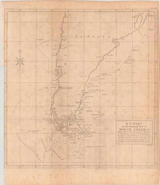
Of particular interest is the large folding map engraved by Richard Seale, A Chart of the Southern Part of South America... (18.4 x 20"). This handsome chart shows the route of Capt. George Anson's expedition from St. Catherine's Island off the coast of Brazil, around Cape Horn and up to Juan Fernandes Island (now known as Robinson Crusoe Island) off the coast of Chili. The chart shows numerous calculations of water depth, ocean currents, and includes navigational notes. A decorative compass rose with fleur-de-lys is positioned in the sea.
The other maps included are:
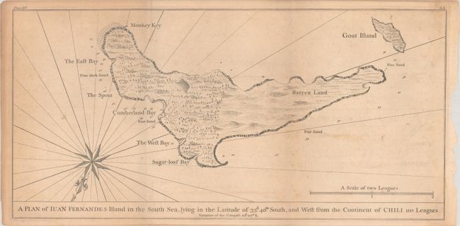
A Plan of Iuan Fernandes Island in the South Sea
A Survey of the North East Side of Iuan Fernandes Island in the South Sea
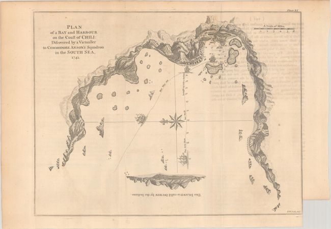
Plan of a Bay and Harbour on the Coast of Chili
Plan of th eTown of Payta in the Kingdom of Santa-Fee
Plan of the East End of the Island of Quibo
The Form of Cruising off Acapulca on the Coast of Mexico
The Bay and Rocks of Petaplan
A Plan of the Harbour of Chequetan or Seguataneo
A Plan of the Harbour of Acapulca [on sheet with] A Plan of the Bay of Manila
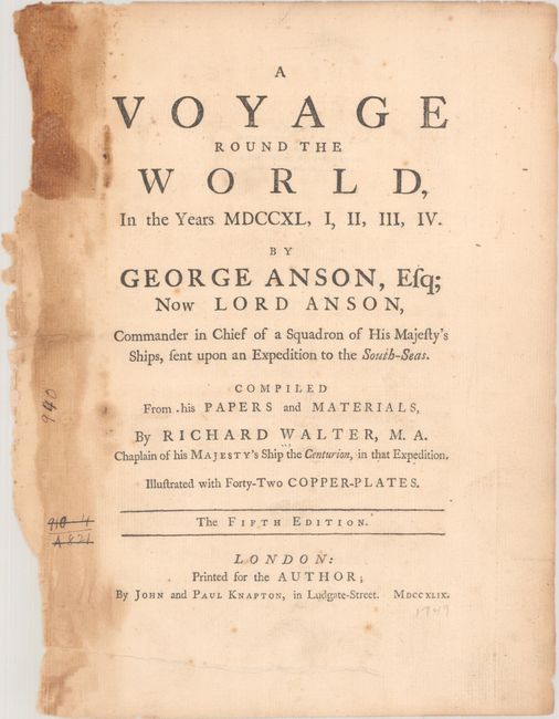
The remaining plates include coastal views, naval battles, and land views. Also included with this lot is the letterpress title page.
References: Shirley (BL Atlases) G.ANS-1e; Mercator's World Nov/Dec 1998 pp. 45-51.
Condition: B
The maps and views have light to moderate toning and foxing, and occasional offsetting from an opposing page of text. A few of the maps and views were trimmed to the neatline on one side by the bookbinder. The large folding map of South America has a 2" binding tear that has been partially repaired with old paper on verso. The title page has heavy toning along the left edge of the sheet and a tear in the bottom margin that has been closed on verso with archival tape.