Subject: Exploration & Surveys, Eastern Asia
Period: 1749 (published)
Publication:
Color: Black & White
Size:
4 x 6.8 inches
10.2 x 17.3 cm
This is the 25th volume of Didot's Histoire Generale Des Voyages... published in 1749. The volume is focused on eastern Asia and contains the following three folding maps:
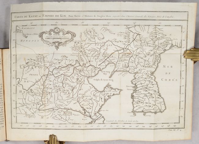
Carte du Katay ou Empire de Kin, Pour Servir a l'Histoire de Jenghiz Khan... (12.3 x 8.2"). This attractive map of Korea and Northern China features a strong depiction of the Great Wall. The Sea of Japan is marked Mer de Coree. Condition: Clean and bright. (A)
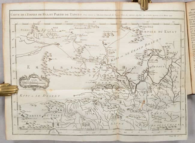
Carte de L'Empire de Hya et Partie de Tangut... (12.1 x 8.6"). A nice map featuring the vast Gobi Desert in present-day northern China and southern Mongolia. Features both the Great Wall and Silk Road. Condition: There is some minor staining and a short archivally repaired fold separation at bottom. (B+)
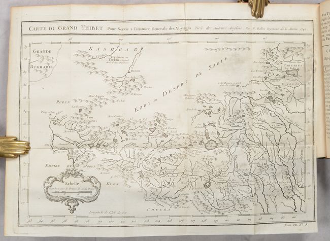
Carte du Grand Thibet... (12.3 x 8.4"). A detailed map of the Himalayas, extending from the Mughal Empire northeast to the Gobi Desert. Depicts the dense and complex mountain system, rivers, lakes, and villages. Condition: Light printer's ink residue. (B+)
427 pages with 3 maps and 1 folding illustration. Hardbound in full calf with gilt title and raised bands on spine.
References:
Condition: B+
See description for map condition/grading. Text is clean, bright and near fine. The folding illustration has some minor creasing and a bit of toning along the right edge. Covers have some light stains and the spine has minor cracking.