Subject: World
Period: 1652 (dated)
Publication:
Color: Hand Color
Size:
21.3 x 14.3 inches
54.1 x 36.3 cm
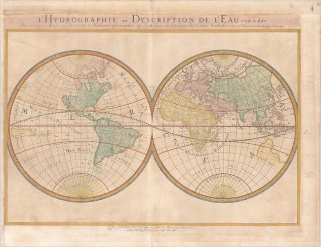
This uncommon double hemisphere world map exemplifies the more austere style of Nicolas Sanson, often referred to as the 'the father of French cartography.' Whereas the Dutch cartographers are known for their fabulous decorations and coloring, the French cartographers, led by Sanson, are known for pioneering the scientific method of cartography. The map is similar to Sanson's 1651 edition (Shirley #390), but with more prominence given to marine and river features. California is shown as an island. On this map, Sanson has renamed Nouvelle Albion in the northwest part of North America as Terra de Iesso, and the Destr. d'Anian has been moved to just north of California. It is one of the first maps to distinguish the Great Lakes. Australia is only partially shown, still marked Beach, and the outline of the southern continent is nearly invisible.
References: Shirley #394; Wagner #367.
Condition: B
A toned sheet with a large coat of arms watermark, an extraneous crease to the right of the centerfold, and a few small spots. There is a professionally repaired tear that just passes the neatline at bottom right.