Subject: North America
Period: 1835-50 (circa)
Publication:
Color: Hand Color
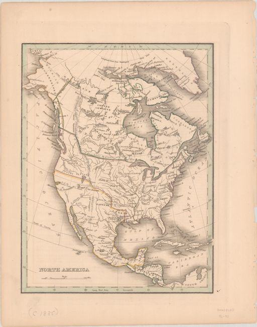
A. North America, by Thomas Gamaliel Bradford, from New Illustrated Atlas, circa 1835 (7.8 x 10.1"). Copper engraved map showing the United States with pre-Mexican American War boundaries and claims into present-day British Columbia. Austin's Colony is located in Texas. Alaska is called Russian Possessions with the "Boundary Settled in 1825." In the west, the R. Buenaventura connects by a dotted line to a large lake named L. Salado and empties into the Pacific at Monterey. A large L. Timpanogos extends into the Snake Indian region. Canada is no longer referred to as Rupert's Land, but rather British America. Condition: Contemporary outline color with a hint of offsetting from an opposing page.
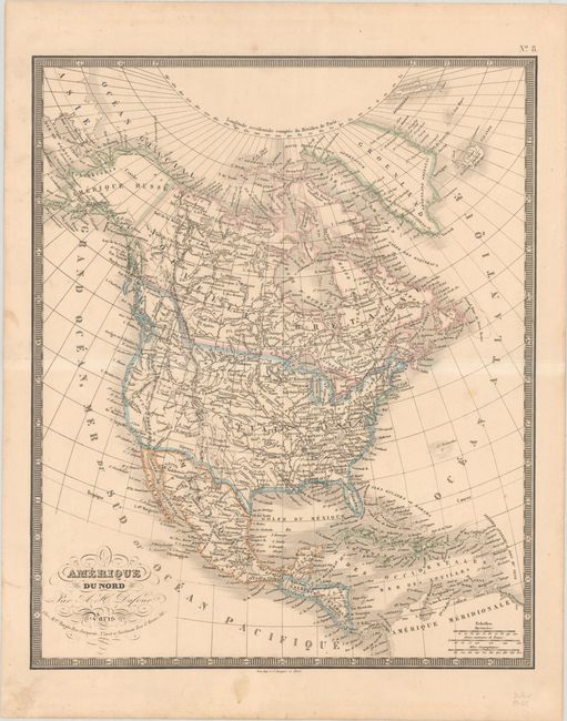
B. Amerique du Nord, by Auguste-Henri Dufour, circa 1850 (13.3 x 16.1"). Handsome rendering of the continent showing the United States with claims into present-day British Columbia. The border between the U.S. and Mexico is along the Gila River, and Alaska is in Russian hands. The map is enclosed in a bold keyboard-style border. Condition: A nice impression with contemporary outline color and light soiling that is mostly confined to the blank margins. There is a short tear in the top margin that has been closed on verso with archival tape.
References:
Condition: A
See description above.