Subject: North America, Texas
Period: 1836 (dated)
Publication:
Color: Black & White
Size:
19.8 x 12.8 inches
50.3 x 32.5 cm
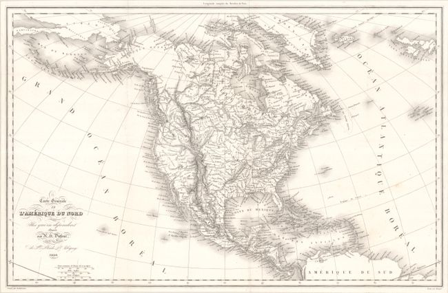
This richly detailed French map of the continent features a vast Territoire Oregon (Oregon Territory) that extends to present-day Nebraska. The Republic of Texas appears with its own borders, and Mexico controls the rest of the Southwest. The stretch of coast south of the Columbia River is Nouvle. Albion, and the Great Basin is labeled Partie inconnue. The western shore of L. Timpanogos is left undefined, with two conjectural rivers connecting it to the Pacific. The newly formed state of Arkansas is delineated. Michigan is still a territory with the Northwest Territory to its west. Alaska is Amerique Russe. Engraved by Desbuisson, with lettering by Benard.
References:
Condition: A
A crisp impression on a bright sheet with a couple minor spots. Issued folding.