Subject: North America
Period: 1846 (circa)
Publication:
Color: Hand Color
Size:
8.4 x 10.3 inches
21.3 x 26.2 cm
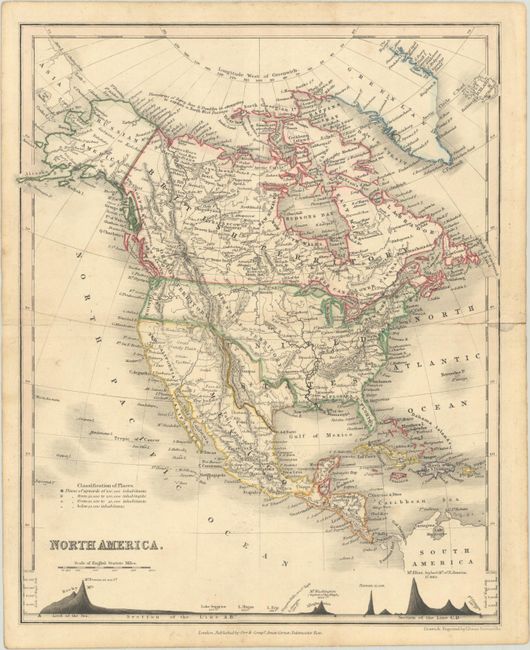
An attractive map of North America showing Texas in its large stovepipe orientation. While Texas is shown with its own borders, parts of the words "United States" overlap, indicating that Texas was transitioning to U.S. statehood. The border issue between the U.S. and Canada in the Pacific Northwest is settled, and the West is called "New California" under Mexican control. Alaska is Russian America, and Canada in its entirely is labeled British Territory. The map extends to include all of Central America and the Caribbean. A cross-section along the bottom shows elevation of major mountains. Published by Orr & Company.
References:
Condition: B+
Contemporary outline color with archivally repaired centerfold separations at left (0.5") and right (1").