Subject: Eastern North America & West Indies
Period: 1821 (circa)
Publication: Voyage en Amerique
Color: Black & White
Size:
10.3 x 13.1 inches
26.2 x 33.3 cm
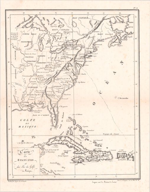
This scarce map of the eastern United States extends to include portions of Canada and the Greater Antilles. It is notable for being one of the earliest U.S. maps printed using lithography as opposed to copper engraving, which was still the standard in the early 19th century. North of the Ohio River, the map presents Indiana, Illinois and North West territories, and in the south Mississippi Territory includes present-day Alabama. In the Northeast, New Hampshire's boundary is delineated but Maine, Quebec and New Brunswick are all labeled close together but not delineated, reflecting the boundary dispute in the region. A doted line throughout much of the map indicates the path of Edouard de Montule, who traveled up the Mississippi and Ohio rivers en route to New York and Philadelphia and wrote an account of his travels. This was one of only two maps published in his Voyage en Amerique.
References: Howes #M-750.
Condition: B+
On a bright sheet with some light scattered foxing.