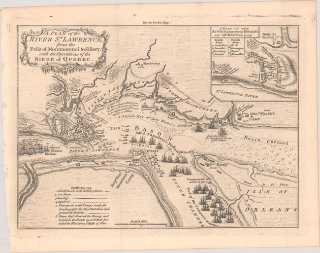
Subject: Quebec City, Canada
Period: 1759 (published)
Publication: London Magazine
Color: Black & White
Size:
9.6 x 6.9 inches
24.4 x 17.5 cm
This is a very detailed map of the Siege of Quebec (1759) during the French & Indian War. The map shows the positions of the two opposing forces with numerous war ships in the river surrounding the city. Admiral Holme's Division is upstream with Admiral Saunder's Division to the east and also up the South Channel. Locates the HMS Centurion in the North Channel just below General Wolfe's land-based camp near the Falls of Montmoreenci. At upper right is a "Plan of the Action gained by the English near Quebec, Sep. 13, 1759." Decorated by a fancy rococo-style title cartouche. Published in the November, 1759 issue of the London Magazine.
References: Jolly #LOND-178.
Condition: A
A nice impression, issued folding. There is a bit of printer's ink residue along the platemark outside of the image.