Current Auction
"United States", Young, James H.
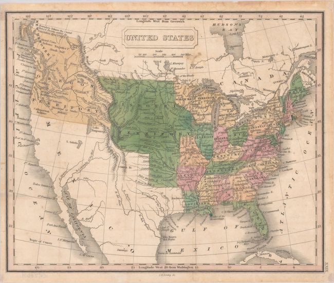
Subject: United States
Period: 1830 (circa)
Publication:
Color: Hand Color
Size:
9.8 x 8.1 inches
24.9 x 20.6 cm
Download High Resolution Image
(or just click on image to launch the Zoom viewer)
(or just click on image to launch the Zoom viewer)
This is an interesting small map covering the United States and the adjoining parts of Canada and Mexico. It shows the United States following the Missouri Compromise with both the state and territory of Missouri depicted. The United States is in control of present-day British Columbia with the "Boundary between the United States & Russia settled by Convention April 5th 1824." The boundary with Mexico is per the Treaty of 1819, with unnamed Texas still a part of Mexico. Lake Timpanogos straddles between Oregon Territory and Mexico, with L. Salado (Salt Lake) farther south. Missouri Territory encompasses the entire Great Plains from Texas to Canada and from the Mississippi River to the Rocky Mountains. Other territories include Michigan, North West, and Arkansas, the capital of which is Little Rock or Arkopolis. The map presents a particularly good view of the rivers and Indian nations in the West.
References:
Condition: B+
Full contemporary color, issued folding and now flattened with light soiling, minor offsetting, and a few tiny holes at fold intersections.
Estimate: $140 - $170
Current High Bid:
$70
Reserve: Reserve Not Met
Next Bid: $75
Bid Increments
$50 - $99$5
$100 - $249$10
$250 - $499$25
$500 - $999$50
Terms & Conditions