Current Auction
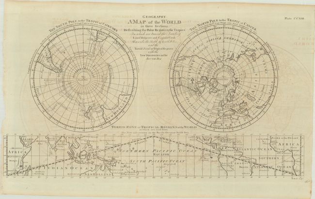
"A Map of the World in Three Sections, Describing the Polar Regions to the Tropics in Which Are Traced the Tracts of Lord Mulgrave and Captain Cook Towards the North & South Poles...", Barker, William
Subject: World
Period: 1786 (circa)
Publication:
Color: Black & White
Size:
16.5 x 9 inches
41.9 x 22.9 cm
Download High Resolution Image
(or just click on image to launch the Zoom viewer)
(or just click on image to launch the Zoom viewer)
This finely engraved double polar projection world map features a rectangular map of the tropical regions, centered on the equator, across the bottom. The southern hemisphere shows Capt. Cook's voyages of 1773, '74, and '75. The northern hemisphere focuses on the 1773 voyages of Captain Phipps, now Lord Mulgrave.
References:
Condition: B+
Issued folding with light offsetting.
Estimate: $160 - $190
Current High Bid:
$0
Reserve: Reserve Not Met
Next Bid: $80
Bid Increments
$50 - $99$5
$100 - $249$10
$250 - $499$25
$500 - $999$50
Terms & Conditions