Current Auction
Scarce Map Depicting the Territory of Pembina
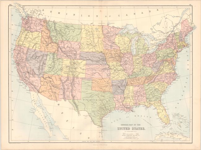
"General Map of the United States", Bartholomew, John
Subject: United States, Pembina
Period: 1875 (circa)
Publication: Black's General Atlas of the World
Color: Printed Color
Size:
22.3 x 16.6 inches
56.6 x 42.2 cm
Download High Resolution Image
(or just click on image to launch the Zoom viewer)
(or just click on image to launch the Zoom viewer)
This scarce map is unique for its depiction of the Territory of Pembina where North Dakota exists today. There was much interest in dividing Dakota Territory in the mid-1870s, and in the Dec. 22nd, 1874 edition of the Sacramento Daily Union under "News of the Morning" is a one sentence note "The Pembina Territory Bill was revived on motion of Boreman" in the U.S. Senate. Bartholomew apparently wanted the jump on other map makers, and thus showed Pembina as a territory. However, Bartholomew does not use a bold font as he does with other states and territories, perhaps recognizing that there was some uncertainty with its status. In later years Bartholomew would depict North Dakota as the Territory of Huron and Lincoln Territory. North and South Dakota were eventually created in 1889.
References:
Condition: B+
A bright example with light dampstaining around the centerfold at bottom.
Estimate: $275 - $350
Current High Bid:
$0
Reserve: Reserve Not Met
Next Bid: $140
Bid Increments
$100 - $249$10
$250 - $499$25
$500 - $999$50
$1,000 - $2,499$100
Terms & Conditions