Current Auction
"Map of the United States, and Territories. Together with Canada &c.", Mitchell, Samuel Augustus
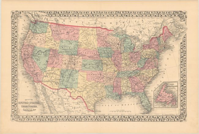
Subject: United States
Period: 1876 (dated)
Publication:
Color: Hand Color
Size:
21.5 x 13.6 inches
54.6 x 34.5 cm
Download High Resolution Image
(or just click on image to launch the Zoom viewer)
(or just click on image to launch the Zoom viewer)
This attractive map of the United States is enclosed in a floral border. Dacotah has not yet split into North and South Dakota, and Oklahoma remains Indian Territory. The recently established Yellowstone National Park (1872) is shown in Wyoming Territory. An extensive railroad network runs throughout the East, while the Transcontinental Railroad and wagon roads are depicted in the western territories. Includes an inset of Newfoundland at bottom right.
References:
Condition: A
Contemporary color on a clean bright sheet. There is a short archivally repaired centerfold separation confined to the top blank margin.
Estimate: $120 - $150
Current High Bid:
$0
Reserve: Reserve Not Met
Next Bid: $60
Bid Increments
$50 - $99$5
$100 - $249$10
$250 - $499$25
$500 - $999$50
Terms & Conditions