Current Auction
"[Lot of 2] [Map with Report] Map Showing Indian Reservations in the United States West of the 84th Meridian... [with] Indian Reservations from the Public Domain [and] Map Showing Indian Reservations Within the Limits of the United States...", U.S. Bureau of Indian Affairs
Subject: United States
Period: 1883-95 (dated)
Publication:
Color: Printed Color
Size:
See Description
Download High Resolution Image
(or just click on image to launch the Zoom viewer)
(or just click on image to launch the Zoom viewer)
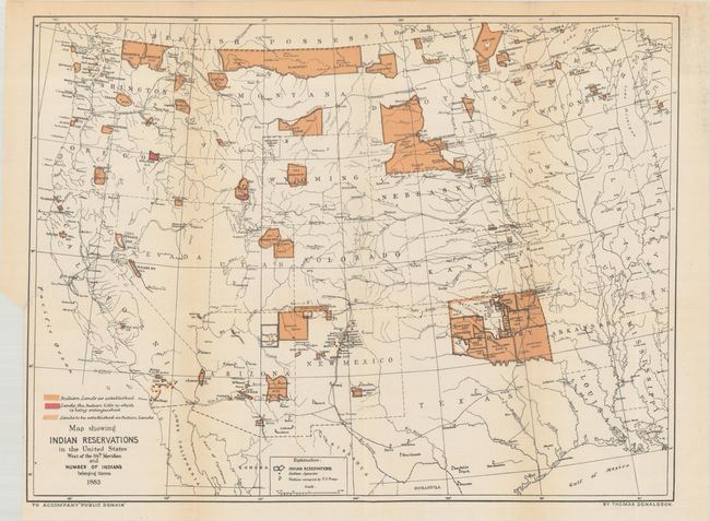
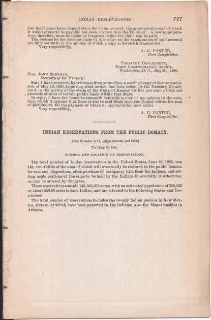
A. [Map with Report] Map Showing Indian Reservations in the United States West of the 84th Meridian and Number of Indians Belonging Thereto [with] Indian Reservations from the Public Domain, by Thomas Donaldson, dated 1883 (17.6 x 13.3"). This early Bureau of Indian Affairs map shows the status of Indian Reservations within the western United States as of 1882. It is precisely drawn to show existing, proposed, and "extinguished" Indian lands via color and line. The map also shows Indian agencies, Army outposts, towns, railroads, and the recently established Yellowstone National Park. Also included with the lot is a disbound 25-page report. Condition: Issued folding with archival tape repairing a few tiny separations at fold intersections. There is a hint of toning along the folds and a binding trim in the bottom left margin with a 3" associated tear that has been closed on verso with archival tape. (B+)
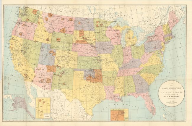
B. Map Showing Indian Reservations Within the Limits of the United States..., dated 1895 (33.3 x 21.2"). This large map of the United States focuses on the many Indian Reservations in the United States as of 1895. The reservations are named and shown in orange overprinting. The map also shows military stations, towns and villages, railroads, Indian agencies, and schools. Includes insets of reservations in California and Indian Territory at bottom. Compiled under the direction of D.M. Browning, Commissioner of Indian Affairs. Condition: A bright, crisp example issued folding with a 0.5" binding tear at left that has been repaired on verso with archival tape. (A)
References:
Condition:
See description above.
Estimate: $275 - $350
Current High Bid:
$0
Reserve: Reserve Not Met
Next Bid: $140
Bid Increments
$100 - $249$10
$250 - $499$25
$500 - $999$50
$1,000 - $2,499$100
Terms & Conditions