Current Auction
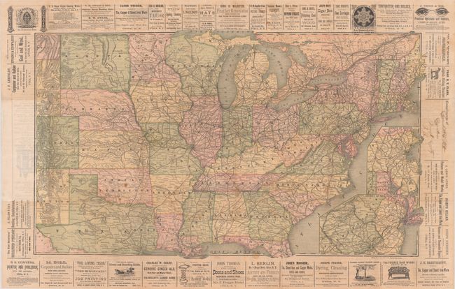
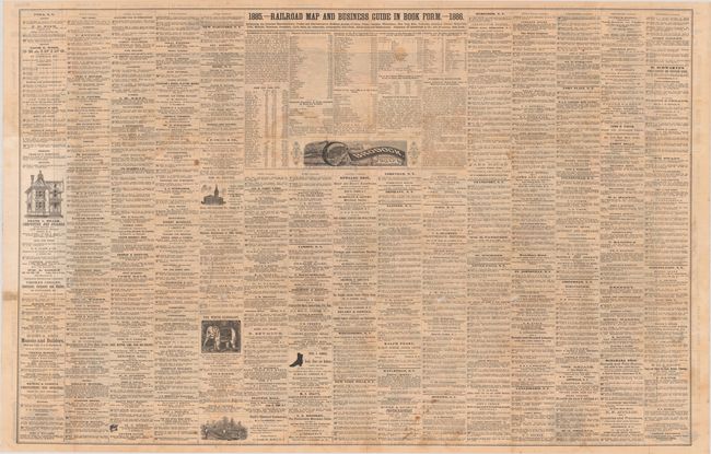
"[Title on Verso] 1885 - Railroad Map and Business Guide in Book Form - 1886", Rand McNally & Co.
Subject: Eastern United States, Railroads
Period: 1885 (dated)
Publication:
Color: Printed Color
Size:
35.3 x 20.8 inches
89.7 x 52.8 cm
Download High Resolution Image
(or just click on image to launch the Zoom viewer)
(or just click on image to launch the Zoom viewer)
This large folding map extends from the eastern seaboard to the Rocky Mountains, including eastern Wyoming, Colorado, and New Mexico. The emphasis of the map is the evolving railroad network with numerous advertisements along its border and on verso dedicated to businesses in New York. Includes inset maps Vicinity of Boston and Vicinity of New York and Philadelphia at lower right. Produced by Rand McNally and published by Hannifan & Company in Buffalo, NY.
References:
Condition: B+
Issued folding with light toning and some small stains. There are archival repairs to tiny holes at fold intersections.
Estimate: $275 - $350
Price: $200
Bid Increments
$100 - $249$10
$250 - $499$25
$500 - $999$50
$1,000 - $2,499$100
Terms & Conditions