Current Auction
"Mappe-Monde en Deux Hemispheres", Lapie, Alexander Emile & Pierre
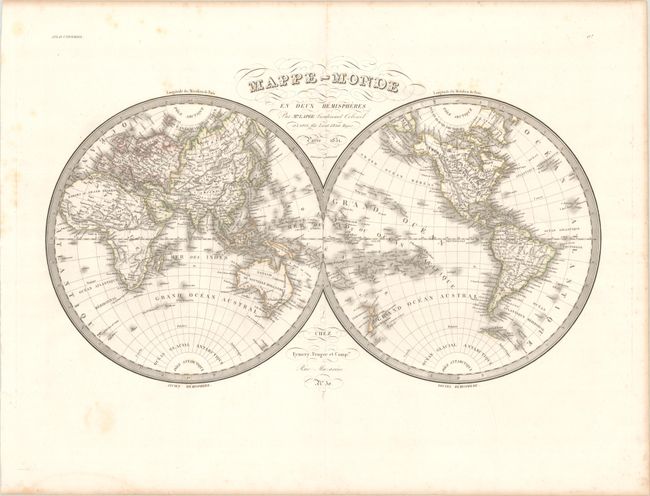
Subject: World
Period: 1831 (dated)
Publication: Atlas Universel
Color: Hand Color
Size:
21.9 x 13.6 inches
55.6 x 34.5 cm
Download High Resolution Image
(or just click on image to launch the Zoom viewer)
(or just click on image to launch the Zoom viewer)
This handsome double hemisphere map presents the world in fine detail including countries, mountains, rivers, seas and oceans. Many islands and island groups appear in the oceans and offshore regions around the world. The map reflects the latest geographic discoveries brought back to Paris by navigators and explorers. The coasts of Australia have now been fully explored and Tasmania, formerly Van Diemen's Land, is now shown separated from Australia by the Bass Strait. New island groups in the Pacific have also been located and named, and a few areas in the Antarctic are beginning to take shape. America's Pacific Northwest coast and Alaska have also been fully explored and charted. Engraved by Lallemand.
References:
Condition: B+
Contemporary outline color on a bright sheet with light scattered foxing mostly in the blank margins and a faint dampstain along the bottom sheet edge. A tiny wormhole along the border of the Eastern Hemisphere is only visible when held to light.
Estimate: $160 - $190
Current High Bid:
$0
Reserve: Reserve Not Met
Next Bid: $80
Bid Increments
$50 - $99$5
$100 - $249$10
$250 - $499$25
$500 - $999$50
Terms & Conditions