Current Auction
"Carte de la Partie Nord, des Etats Unis, de l'Amerique Septentrionale", Bonne, Rigobert
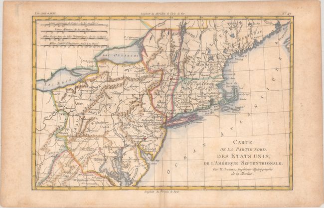
Subject: New England & Mid-Atlantic United States
Period: 1783 (circa)
Publication: Raynal's Histoire Philosophique et Politique…
Color: Hand Color
Size:
12.7 x 8.5 inches
32.3 x 21.6 cm
Download High Resolution Image
(or just click on image to launch the Zoom viewer)
(or just click on image to launch the Zoom viewer)
This very early map presents the northern part of the newly-formed United States. It covers the region from northern Virginia to Maine (Machasuzet Bay), and westward to include Lake Erie. The map has good topographical detail, and it also includes numerous settlements, forts, and Indian villages. It locates Baltimore, Annapolis, Alexandria, New York, Philadelphia, Boston, Ft. Halifax, and much more. There are four distance scales at upper left.
References: McCorkle #782.1A; Sellers & van Ee #744.
Condition: B
A nice impression with light foxing and soiling. There is a split and chip along the centerfold at bottom that has been repaired with old paper, with a short portion of the border and the "Mer" of "Meridien" replaced in facsimile.
Estimate: $100 - $130
Price: $75
Bid Increments
$50 - $99$5
$100 - $249$10
$250 - $499$25
$500 - $999$50
Terms & Conditions