Current Auction
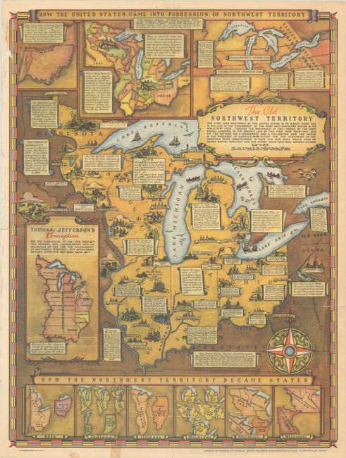
"The Old Northwest Territory - The First Step Westward by the United States in Its March from Sea to Sea..."
Subject: Upper Midwestern United States
Period: 1937 (circa)
Publication:
Color: Printed Color
Size:
16.6 x 22.2 inches
42.2 x 56.4 cm
Download High Resolution Image
(or just click on image to launch the Zoom viewer)
(or just click on image to launch the Zoom viewer)
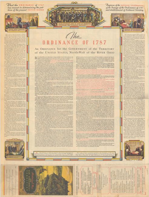
This fascinating map was issued at the 150th anniversary of the signing of the Northwest Ordinance of 1787 and was published by The Northwest Territory Celebration Commission. The sheet features inset maps at bottom depicting how each state was formed, with insets at top showing the various Indian treaties that allowed settlement to extend west. The main map image is filled with historical notations and illustrations, and is decorated by a large compass rose. The verso contains the full text of the 1787 ordinance.
References:
Condition: B
Issued folding with a small hole and an adjacent tear in the border at top left, as well as several short fold separations that have been closed on verso. A 3" tear at bottom was previously closed with cello tape, causing a light stain, and the cello tape has since been removed and replaced with archival tape.
Estimate: $100 - $130
Price: $75
Bid Increments
$50 - $99$5
$100 - $249$10
$250 - $499$25
$500 - $999$50
Terms & Conditions