Current Auction
"[Map in Book] Map to Illustrate Capt. Bonneville's Adventures Among the Rocky Mountains [in] The Adventures of Captain Bonneville, U.S.A., in the Rocky Mountains and the Far West...", Irving, Washington

Subject: Western United States
Period: 1849 (published)
Publication:
Color: Black & White
Size:
18.3 x 11.3 inches
46.5 x 28.7 cm
Download High Resolution Image
(or just click on image to launch the Zoom viewer)
(or just click on image to launch the Zoom viewer)
This interesting map is based on Fremont's map. The region west of the Mississippi to the Pacific Ocean is delineated with the rivers and towns of the gold region in California well shown. The expedition route described is that of Captain Benjamin Bonneville who explored the American West from 1832-1836. The expedition party traveled parallel to the course of the Snake and the Columbia Rivers, going as far as Fort Walla Walla before turning back. Fremont's route through California is shown, as well as Kearny's route along the Gila River and the Emigrant route.
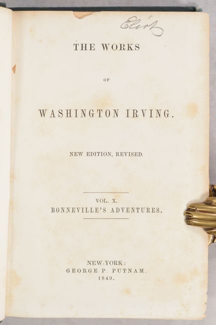
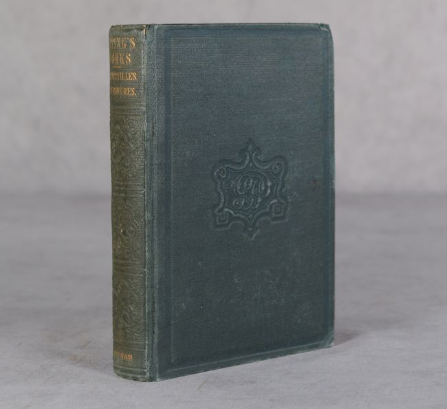
The map is still bound in the original "The Adventures of Captain Bonneville, U.S.A., in the Rocky Mountains and the Far West" (5.3 x 7.5"). Published complete in one volume, this is the 1849 "Author's Revised Edition" of Irving's popular works that provides a historical account of Bonneville's three year exploration of the Rocky Mountains. Bonneville did not submit any reports to his superiors in Washington during his hiatus, thus causing the U.S. Army to declare him "virtually deceased," and subsequently removed from the military roster. 428 pp. Hardbound in green cloth with gilt title on spine and heavy embossed design on covers. A historical and desirable map complete in the original volume.
References: Wagner-Camp #67:14, cf. Wheat (TMW) #424.
Condition: B
The map has light, uneven toning, some misfolding, and a short binding tear at right that has been closed on verso with archival tape. The text is bright with light, scattered foxing, although the title page has more significant foxing. The end papers are moderately toned with several previous owners' names in manuscript ink on the front free-endpaper. The covers show light wear, and the front cover is nearly detached.
Estimate: $200 - $230
Current High Bid:
$190
Reserve: Reserve Met
Next Bid: $200
Bid Increments
$100 - $249$10
$250 - $499$25
$500 - $999$50
$1,000 - $2,499$100
Terms & Conditions