Current Auction
Locates Jackson Hole and the Tetons
"[Lot of 2 - Geological and Topographical] Parts of Western Wyoming and Southeastern Idaho", Hayden, Ferdinand Vandeveer
Subject: Wyoming & Idaho
Period: 1883 (published)
Publication: Hayden's 12th Annual Report
Color: Printed Color
Size:
32.8 x 22.8 inches
83.3 x 57.9 cm
Download High Resolution Image
(or just click on image to launch the Zoom viewer)
(or just click on image to launch the Zoom viewer)
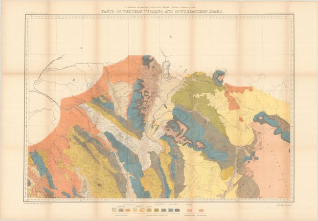
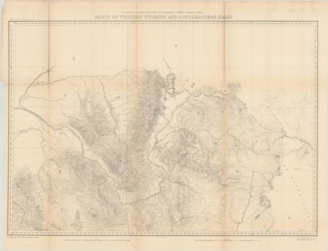
These two maps were issued in Hayden's 12th Annual Report for 1879, but not published until 1883. The maps are identical in size and scale, and show the region from the Wind River Range west to the Blackfoot Range, with Jackson Lake and Grand Teton at center. The maps show excellent detail of topography and the river systems, and virtually no settlements are identified. In addition to the topographical features found on both maps, the geological map uses bold color and pattern to depict 12 different geologic types including recent deposits, sedimentary formations, metamorphic and eruptive rocks. A nice pair of maps that is uncommonly seen together.
See also lot 784 for Carl Wheat's Mapping the Transmississippi West that describes this map.
References: Wheat (TMW) #1296.
Condition: B
There is light toning along the fold lines of both maps. The geological map has been backed with tissue to reinforce and repair a number of short fold separations. The topographical map has several fold separations that have been mostly closed on verso with archival tape with some small loss along two vertical folds at top.
Estimate: $150 - $180
Price: $110
Bid Increments
$50 - $99$5
$100 - $249$10
$250 - $499$25
$500 - $999$50
Terms & Conditions