Current Auction
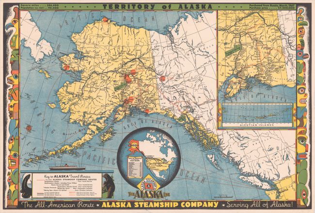
"Territory of Alaska"
Subject: Alaska
Period: 1949 (dated)
Publication:
Color: Printed Color
Size:
30.1 x 20.2 inches
76.5 x 51.3 cm
Download High Resolution Image
(or just click on image to launch the Zoom viewer)
(or just click on image to launch the Zoom viewer)
This colorful map of the then-Territory of Alaska was created by Frank McCaffrey and published by the Alaska Steamship Company. It displays the company's steamship routes in orange overprinting along with railroad lines, highways, and proposed highway routes. Features inset maps of southern Alaska and the United States, and is surrounded by a very distinctive totem pole border.
References:
Condition: A
Clean and colorful with a couple of tiny edge tears at bottom closed on verso with archival tape. Issued folding.
Estimate: $100 - $130
Price: $75
Bid Increments
$50 - $99$5
$100 - $249$10
$250 - $499$25
$500 - $999$50
Terms & Conditions