Current Auction
"Orbis Terrarum Veteribus Cogniti Typus Geographicus", Cluver/Jansson
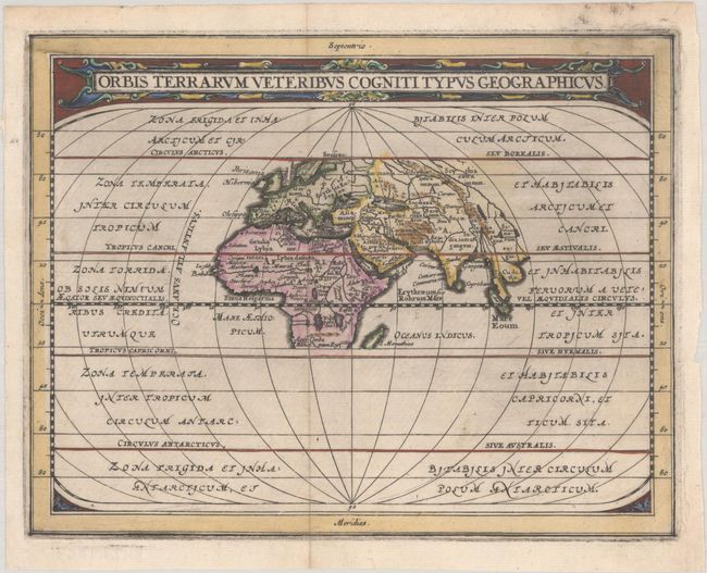
Subject: Ancient World
Period: 1661 (published)
Publication: Introductionis in Universam Geographicam
Color: Hand Color
Size:
8.1 x 6.4 inches
20.6 x 16.3 cm
Download High Resolution Image
(or just click on image to launch the Zoom viewer)
(or just click on image to launch the Zoom viewer)
This is a reduced version of the classic map of the ancient world based on Ortelius. Europe, Asia, and Africa (as far south as Madagascar) are placed at the center of a much larger oval frame that continues to the Antarctic. The climatic zones are identified. The title is enclosed in a lovely strapwork panel at top.
References: cf. Shirley (BL Atlases) T.CLUV-6a #1.
Condition: A
A dark impression on a bright sheet with a "WR" watermark, light printer's ink residue, and a hint of soiling.
Estimate: $140 - $170
Current High Bid:
$0
Reserve: Reserve Not Met
Next Bid: $70
Bid Increments
$50 - $99$5
$100 - $249$10
$250 - $499$25
$500 - $999$50
Terms & Conditions