Current Auction
"Georgia", Greenleaf, Jeremiah
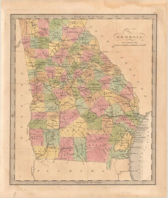
Subject: Georgia
Period: 1840 (circa)
Publication: A New Universal Atlas
Color: Hand Color
Size:
10.8 x 12.5 inches
27.4 x 31.8 cm
Download High Resolution Image
(or just click on image to launch the Zoom viewer)
(or just click on image to launch the Zoom viewer)
Hand colored by county, this handsome map of the state delineates roads, towns, villages and settlements, ports, watershed, and more. It updates the Burr/Illman map with the addition of Walker County in the northwest corner, bringing the county configuration up to date to 1837. An early railroad connects Macon and Savannah, and another links Athens and Warrenton. Atlanta has not yet been established. Surrounded by a keyboard-style border and with fancy titling. Jeremiah Greenleaf took over the production of David Burr's New Universal Atlas when Burr was appointed Geographer of the House of Representatives in 1838.
References: Rumsey #4850.052.
Condition: B
Full contemporary color on a lightly toned sheet with light dampstaining that enters the border at bottom left and top right. A short wormtrack in Union County at top has been infilled with old paper on verso, with a small portion of image loss.
Estimate: $200 - $230
Price: $150
Bid Increments
$100 - $249$10
$250 - $499$25
$500 - $999$50
$1,000 - $2,499$100
Terms & Conditions