Current Auction
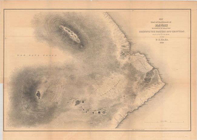
"Map of Part of the Island of Hawaii Sandwich Islands Shewing the Craters and Eruption of May and June 1840", Wilkes, Charles
Subject: Hawaii
Period: 1841 (dated)
Publication: Narrative of the United States Exploring Expedition
Color: Black & White
Size:
23.7 x 15.5 inches
60.2 x 39.4 cm
Download High Resolution Image
(or just click on image to launch the Zoom viewer)
(or just click on image to launch the Zoom viewer)
This large-format map shows the rugged topography of the southeastern portion of the island via hachure and locates the volcanoes of Mauna Loa, Mauna Kea, and Kilauea. In addition to the topography, the map depicts the tracks of the Exploring Expedition to the crater of Moku-a-weo-weo on the top of Mauna Loa. Numerous towns and villages are identified along the coast including Hilo. The map was based upon Wilkes' own observations and is considered one of the most detailed of its time.
References:
Condition: B
Issued folding with light toning and offsetting, and archival repairs to a few short fold separations. Binding trim at lower left.
Estimate: $200 - $230
Price: $150
Bid Increments
$100 - $249$10
$250 - $499$25
$500 - $999$50
$1,000 - $2,499$100
Terms & Conditions