Current Auction
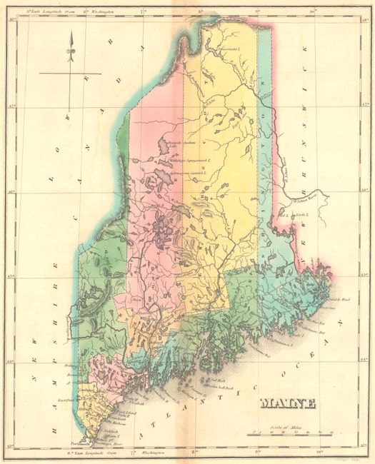
"Geographical, Statistical, and Historical Map of Maine", Carey & Lea
Subject: Maine
Period: 1822 (circa)
Publication: A Complete Historical, Chronological, and Geographical American Atlas
Color: Hand Color
Size:
9.8 x 11.9 inches
24.9 x 30.2 cm
Download High Resolution Image
(or just click on image to launch the Zoom viewer)
(or just click on image to launch the Zoom viewer)
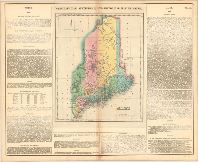
This map of the new state of Maine was beautifully engraved by J. Yeager. It shows the state with only nine counties and a population of less than 300,000. There is good detail of the extensive system of lakes and rivers. Wagon roads are limited to the southern portion, most connecting the coastal towns. Bangor and Canaan, as well as many small villages are named. A handsome map on a full folio sheet (21.5 x 17.6") with surrounding text giving historical, physical, and political information. A table lists all governors current to Albion K. Parris, 1821; from 1652 to 1820, Maine was under the jurisdiction of Massachusetts.
References:
Condition: B+
Full contemporary color with light toning along the centerfold and a bit of offsetting.
Estimate: $120 - $150
Price: $90
Bid Increments
$50 - $99$5
$100 - $249$10
$250 - $499$25
$500 - $999$50
Terms & Conditions