Current Auction
Rare Set of Revolutionary War Period Views of Boston
"[On 2 Sheets - 6 Views of Boston]", Des Barres, Joseph Frederick Wallet
Subject: Boston, Massachusetts
Period: 1775 (dated)
Publication: The Atlantic Neptune
Color: Black & White
Size:
24.9 x 33.4 inches
63.2 x 84.8 cm
Download High Resolution Image
(or just click on image to launch the Zoom viewer)
(or just click on image to launch the Zoom viewer)
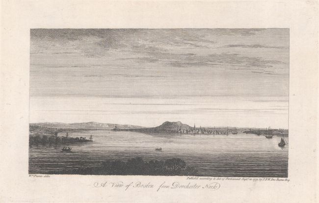
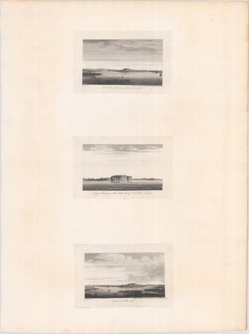
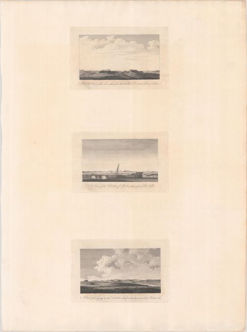
This rare set includes two sheets with 6 views of Boston from both before and during the Revolutionary War. Three of the views depict Boston from different vantage points, with two of these attributed to William Pierie, a British artillery officer who drew a series of views of Boston in 1773. The artists of the remaining four views are unknown. One of the most interesting aspects of these 6 views is that some were drawn prior to the Revolutionary War, and some after, as evidenced by the entrenched "lines" in one view and soldiers in a redoubt in another. The views also demonstrate the changes in topography around Botson, with a depiction of the "triple peaks" that were later cut down to provide landfill. Measurement is for the full sheets; individual views measure 8.2 x 4.6".
A. A View of Boston from Dorchester Neck [on sheet with] Long Island Open on the North Side of Nicks Mate Island [and] Boston from Willis Creek
B. A Front View of the Lines Taken from the Advanced Post Near Browns House [on sheet with] A View of the Harbour of Boston Taken from Fort Hill [and] A View of the Country Towards Dorchester, Taken from the Advanced Works on Boston Neck
Joseph Des Barres was a military engineer with the British Royal American Regiment. At the conclusion of the French and Indian war, he surveyed the coastlines of Nova Scotia, Newfoundland, and the Gulf of St. Lawrence. Upon his return to London in 1774, the Royal Navy assigned him the task of producing an atlas of new, accurate sea charts of Britain's empire in North America. In addition to his charts of the Canadian waters, he compiled the manuscripts of British cartographers in the American Colonies, Jamaica, and Cuba and produced one of the most important sea atlases of the era, The Atlantic Neptune, published between 1777 and 1781. It contained the first systematic survey of the east coast of North America, consisting of four volumes and over 250 charts and views.
References: cf. Deak (Picturing America) #132; Shirley (BL Atlases) M.DES-1b.
Condition: A
Sharp impressions on sturdy sheets with a hint of toning. The sheet with the view of "Boston from Dorchester Neck" has a "J. Whatman" watermark, and the second sheet has a "J. Barres" watermark. The second sheet has a bit of toning within the titles below the views. There are a couple of edge tears that have been professionally repaired.
Estimate: $2,750 - $3,500
Current High Bid:
$2,000
Reserve: Reserve Met
Next Bid: $2,100
Bid Increments
$1,000 - $2,499$100
$2,500 - $4,999$250
$5,000 - $9,999$500
$10,000 - $24,999$1,000
Terms & Conditions