Current Auction
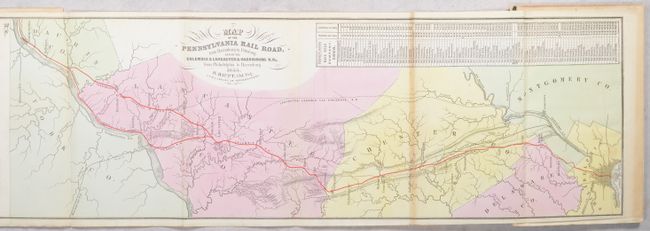
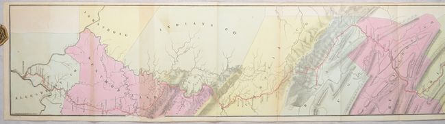
"[Map in Book] Map of the Pennsylvania Rail Road, from Harrisburg to Pittsburg; and of the Columbia & Lancaster & Harrisburg R.Rs. from Philadelphia to Harrisburg [in] Guide for the Pennsylvania Railroad...", Duval, P.S. & Son
Subject: Pennsylvania
Period: 1855 (published)
Publication:
Color: Hand Color
Size:
70.3 x 8.4 inches
178.6 x 21.3 cm
Download High Resolution Image
(or just click on image to launch the Zoom viewer)
(or just click on image to launch the Zoom viewer)
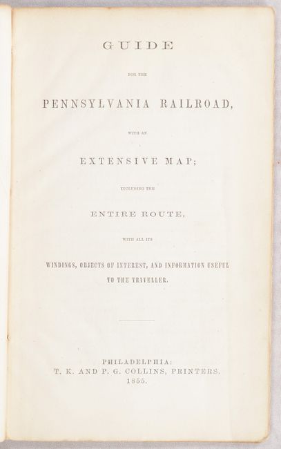
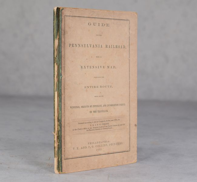
This long and uncommon strip map of the Pennsylvania Railroad was one of the first maps to show the entire line from Philadelphia to Pittsburgh. It was reached in 1852 using the Portage Railroad, and in 1854 using the Horseshoe Curve and the Gallitzin Tunnel. The map was published by P. S. Duval & Co's Steam Lith. Press, Philadelphia in Guide for the Pennsylvania Railroad with an Extensive Map; including the Entire Route, with All Its Windings, Objects of Interest, and Information Useful to the Traveler. The Pennsylvania Railroad grew to be the largest railroad in the United States. 40 pages. Hardbound in gray printed boards.
References: Modelski #517.
Condition: B+
Condition code is for the folding map, which has contemporary color with some occasional light toning. Text is mostly clean and bright. Covers are lightly soiled, foxed and detached from the text block.
Estimate: $200 - $230
Price: $120
Bid Increments
$100 - $249$10
$250 - $499$25
$500 - $999$50
$1,000 - $2,499$100
Terms & Conditions