Current Auction
"Colton's New Township Map of the State of Pennsylvania", Colton, G.W. & C.B.
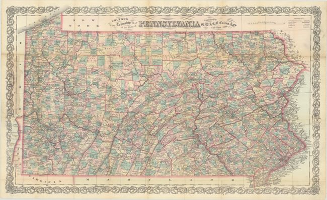
Subject: Pennsylvania
Period: 1880 (dated)
Publication:
Color: Hand Color
Size:
26.6 x 16.2 inches
67.6 x 41.1 cm
Download High Resolution Image
(or just click on image to launch the Zoom viewer)
(or just click on image to launch the Zoom viewer)
This pocket map of the state is intricately detailed, with counties subdivided into individually colored townships. The robust railroad network is delineated throughout, including many named lines. Counties are consistent with present-day configurations, having added the final county, Lackawanna, in 1878. Given the level of detail shown, the map would have been ideal for travelers passing through the state at the time. Surrounded by an elaborate decorative border. Issued on thin banknote-style paper. Covers not present.
References:
Condition: B+
Issued folding and now flat with professional repairs to a number of small fold separations on verso. There is some minute loss at several fold junctions along the upper horizontal fold and minor staining along the left border where the map was previously attached to covers.
Estimate: $160 - $190
Price: $120
Bid Increments
$50 - $99$5
$100 - $249$10
$250 - $499$25
$500 - $999$50
Terms & Conditions