Current Auction
"Carte du Ciel"
Subject: Celestial
Period: 1973 (dated)
Publication:
Color: Printed Color
Size:
45.6 x 33.8 inches
115.8 x 85.9 cm
Download High Resolution Image
(or just click on image to launch the Zoom viewer)
(or just click on image to launch the Zoom viewer)
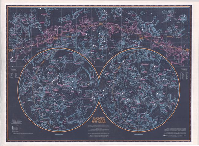
This vivid "Sky Map" was published by the Institut Geographique National (IGN) in Paris. It shows the major constellations both as they appear in the sky above (at top) as well as in spheres (at bottom) centered on the northern and southern equatorial poles. The map also indicate the stars that are visible to the naked eye for each month of the year via the ecliptic. The map uses beautiful dark colors to symbolize the night sky and was "intended for amateur astronomers or people wishing to have a map that is both decorative and complete."
References:
Condition: A
Issued folding and now flattened and backed with tissue. There are a few minor creases, otherwise fine. The map was stored rolled and does not lay flat on its own.
Estimate: $140 - $170
Current High Bid:
$210
Reserve: Reserve Met
Next Bid: $220
Bid Increments
$100 - $249$10
$250 - $499$25
$500 - $999$50
$1,000 - $2,499$100
Terms & Conditions