Current Auction
"[Lot of 3] Geology Sheet XIX - Mammoth Hot Springs and Vicinity [and] Topography Sheet XVIII - Mammoth Hot Springs and Vicinity [and] Topography Sheet XX - Detail Map of Mammoth Hot Springs Travertine Terraces", U.S. Geological Survey (USGS)
Subject: Yellowstone, Wyoming
Period: 1904 (dated)
Publication: Monograph XXXII - Yellowstone National Park
Color: Printed Color
Size:
See Description
Download High Resolution Image
(or just click on image to launch the Zoom viewer)
(or just click on image to launch the Zoom viewer)
These three maps were issued in the Geological Survey's monograph on Yellowstone National Park under the direction of Charles D. Walcott.
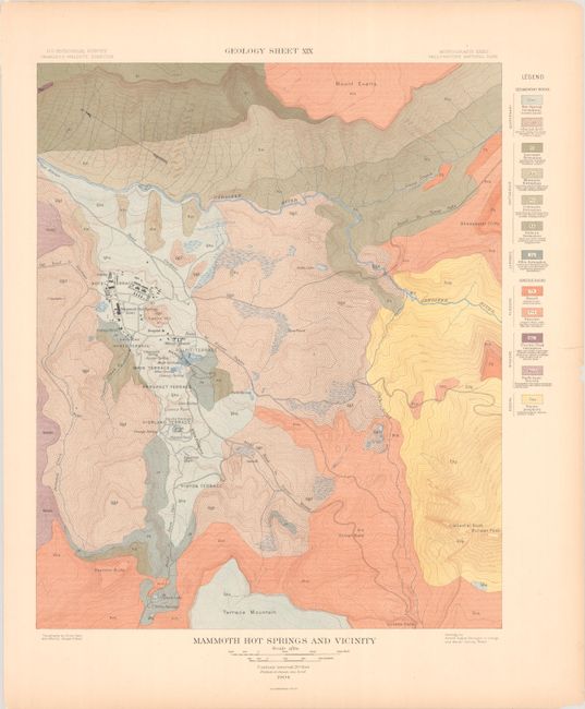
A. Geology Sheet XIX - Mammoth Hot Springs and Vicinity (14.4 x 17.4"). Features 12 different geological groups identified by both color and texture. Includes excellent topographical details based upon the map below.
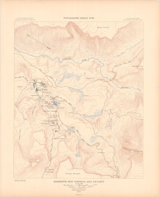
B. Topography Sheet XVIII - Mammoth Hot Springs and Vicinity (14.3 x 17.4"). Depicts the Mammoth Hot Springs Hotel and adjacent military quarters near the center of the image. Shows several roads in the vicinity including: Road to Snow Gate, Stage Road to Geyser Basin, Road to Geyser Basin, Road to Tower Falls, and Road to Gardiner. The map features highly detailed topography showing the rugged nature of the area with numerous lakes and ponds depicted throughout.
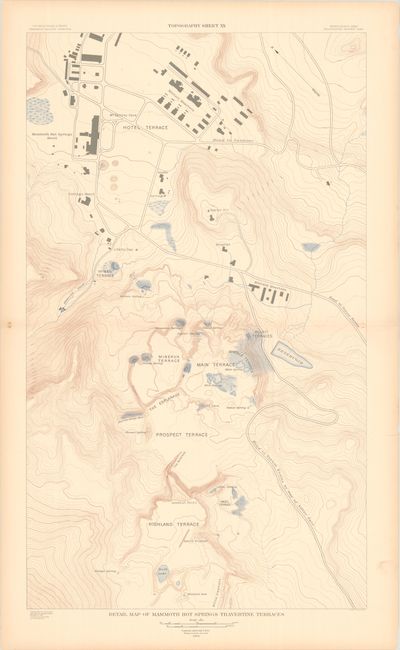
C. Topography Sheet XX - Detail Map of Mammoth Hot Springs Travertine Terraces (18.6 x 31.4"). Double-page map enlarged to focus on the vicinity around the hotel and military quarters. Shows additional buildings including a hospital, cottage, stable, and others. Drawn on a scale of 200 feet per inch.
References:
Condition: A
There is faint toning along sheet edges and a few minor edge chips confined to the blank margins.
Estimate: $140 - $170
Price: $100
Bid Increments
$50 - $99$5
$100 - $249$10
$250 - $499$25
$500 - $999$50
Terms & Conditions