Current Auction
NO RESERVE
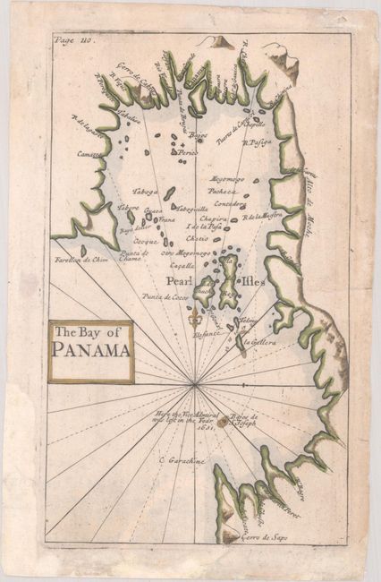
"The Bay of Panama", Anon.
Subject: Panama Bay, Panama
Period: 1770 (circa)
Publication:
Color: Hand Color
Size:
4 x 6.8 inches
10.2 x 17.3 cm
Download High Resolution Image
(or just click on image to launch the Zoom viewer)
(or just click on image to launch the Zoom viewer)
This striking small map focuses on Panama Bay and names several of the Pearl Islands. It spans from Punta Chame to Garachine and shows mountains and the mouths of several rivers. A note off the coast indicates "Here the Vice Admiral was lost in the Year 1631." This map is not listed in Captain Kit Kapp's carto-bibliography of maps of Panama.
References:
Condition: B+
There is light soiling and archival repairs to small chips and tears that are mostly confined to the margins, except for a 0.5" edge tear at right.
Estimate: $90 - $120
Current High Bid:
$21
Reserve: Reserve Met
Next Bid: $22
Bid Increments
Under $50$1
$50 - $99$5
$100 - $249$10
$250 - $499$25
$500 - $999$50
Terms & Conditions