Current Auction
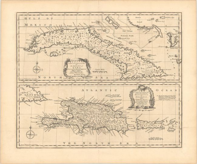
"A New & Accurate Map of the Island of Cuba. Drawn from the Most Approved Maps & Charts... [on sheet with] A New & Accurate Map of the Islands of Hispaniola or St. Domingo, and Porto Rico...", Bowen, Emanuel
Subject: Greater Antilles
Period: 1747 (circa)
Publication: A Complete System of Geography...
Color: Black & White
Size:
16.6 x 13.8 inches
42.2 x 35.1 cm
Download High Resolution Image
(or just click on image to launch the Zoom viewer)
(or just click on image to launch the Zoom viewer)
Two detailed and beautifully engraved maps on a single sheet, one showing Cuba and the other depicting Hispaniola and Puerto Rico. Both are "Drawn from the most approved Maps and Charts, and Regulated by Astron'l Observat'ns." Each map is graced by a charming rococo-style cartouche and includes a compass rose.
References: Shirley (BL Atlases) T.BOW-2a #65.1 & #65.2.
Condition: A
A crisp impression on paper with a Strasbourg Bend & Lily watermark. There is some faint offsetting.
Estimate: $240 - $300
Current High Bid:
$0
Reserve: Reserve Not Met
Next Bid: $120
Bid Increments
$100 - $249$10
$250 - $499$25
$500 - $999$50
$1,000 - $2,499$100
Terms & Conditions