Current Auction
"[Lot of 2] Isla de Cuba [and] Isla de Cuba - Medias Hojas Extremas Oriental y Occidental o de Derecha y Izquierda", Coello y Quesada, Francisco
Subject: Cuba & Havana
Period: 1851-53 (dated)
Publication:
Color: Hand Color
Size:
See Description
Download High Resolution Image
(or just click on image to launch the Zoom viewer)
(or just click on image to launch the Zoom viewer)
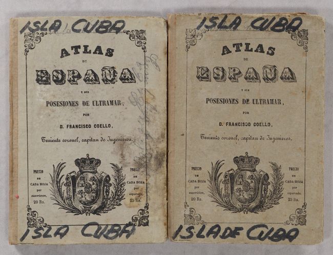
Francisco Coello de Portugal y Quesada (1822-1898) was a Spanish cartographer and military professional who authored an atlas of Spanish possessions overseas, Atlas de Espana e sus Posesiones de Ultramar, published in Madrid between 1848 and 1869. The atlas was created as an accompaniment to the Diccionario Geografico Estadistico Historico by Pascual Madoz. Although 65 maps were originally planned, only 45 maps were eventually completed. Each map was issued in folded form with pocket map covers bearing the title of the publication. Coello studied at the Academia de Ingenieros de Guadalajara (Academy of Engineering in Guadalajara) and was assigned as Lieutenant Colonel of the Spanish Corps of Engineers and stationed in Algeria in 1844. Coello founded the Sociedad Geografica de Madrid (Geographical Society of Madrid) in 1876, which later became the Real Sociedad Geografica de Espana (Royal Geographical Society of Spain).
This lot includes two of the maps from the atlas:
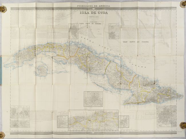
A. Isla de Cuba, dated 1853 (43.0 x 29.4"). This large folding map of Cuba is densely engraved with detail, and is based on the work of Don Pascual Madoz and Tomas O'Ryan. The map includes geographical, political, topographical, and navigational information, extending north to include part of the Florida Keys and the Great Bahama Bank. There are numerous insets with bird's-eye plans of various cities and a large inset of the region surrounding Havana. Blocks of text surrounding the map give additional information on the island.
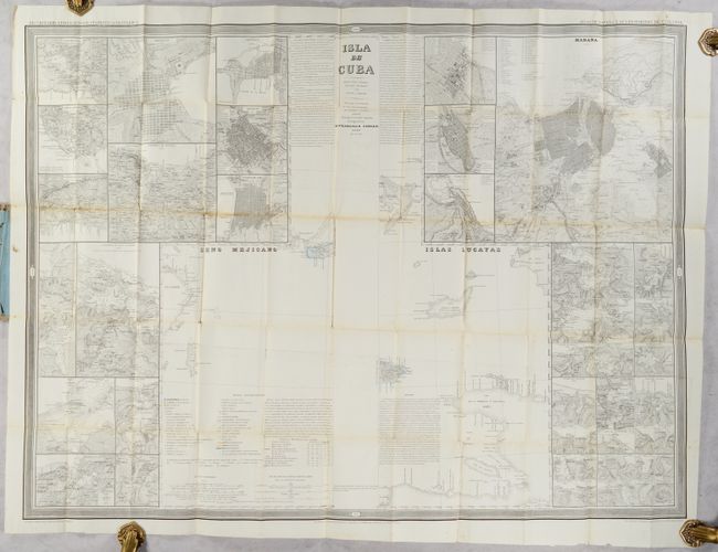
B. Isla de Cuba - Medias Hojas Extremas Oriental y Occidental o de Derecha y Izquierda, dated 1851 (40.3 x 29.4"). The central portion of this large folding map shows the far western and eastern tips of Cuba and extends to the Yucatan and Haiti. The map is surrounded by 48 inset maps with city plans and maps of various harbors in and around Cuba. The largest of these is a bird's-eye plan of Havana and the surrounding area, showing the streets of the city with a numbered key identifying 47 locations.
References: Cueto #84.
Condition: B+
Maps are issued folding with contemporary outline color, short splits at fold intersections, light offsetting, and a few small spots. On the first map, two 2" fold separations at top and a 1" tear at bottom have been closed on verso with tape. On the second map, a 6" fold separation at bottom has been closed on verso with tape. The covers are worn and soiled with "Isla Cuba" written in black permanent ink.
Estimate: $900 - $1,100
Current High Bid:
$0
Reserve: Reserve Not Met
Next Bid: $450
Bid Increments
$250 - $499$25
$500 - $999$50
$1,000 - $2,499$100
$2,500 - $4,999$250
Terms & Conditions