Current Auction
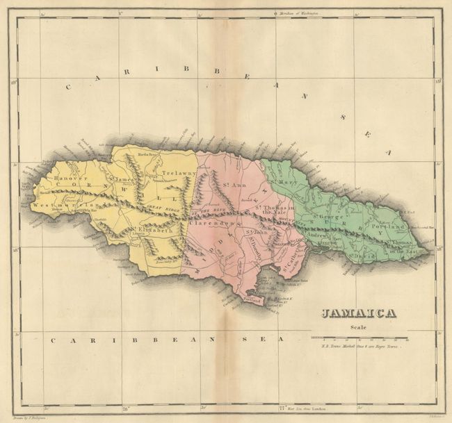
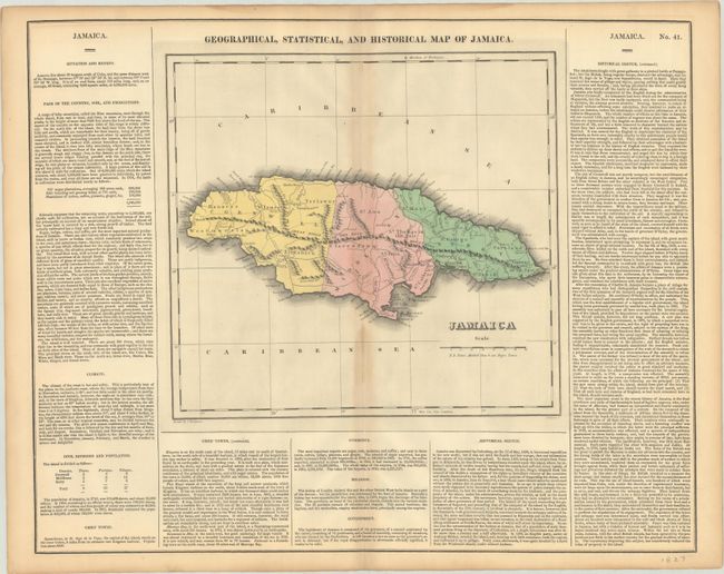
"Geographical, Statistical, and Historical Map of Jamaica", Carey & Lea
Subject: Jamaica
Period: 1827 (circa)
Publication: A Complete Historical, Chronological, and Geographical American Atlas
Color: Hand Color
Size:
12.1 x 11.4 inches
30.7 x 29 cm
Download High Resolution Image
(or just click on image to launch the Zoom viewer)
(or just click on image to launch the Zoom viewer)
This map of Jamaica is divided into the counties of Cornwall, Middlesex, and Surry and depicts the mountainous terrain, coastal towns, and major roads on the island. The map is surrounded by panels of English text with statistical and historical information on each of the islands. Drawn by J. Finlayson and engraved by P.E. Hamm. On a full sheet of English text measuring 22.3 x 17.6".
References:
Condition: B+
Contemporary color with light toning along the centerfold and sheet edges. There is some light waviness to the paper adjacent to the centerfold, which has been reinforced with archival tape on verso.
Estimate: $150 - $180
Current High Bid:
$0
Reserve: Reserve Not Met
Next Bid: $75
Bid Increments
$50 - $99$5
$100 - $249$10
$250 - $499$25
$500 - $999$50
Terms & Conditions