Current Auction
NO RESERVE
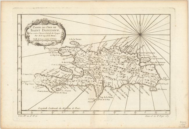
"Carte de l'Isle de Saint Domingue, pour Servir a l'Histoire Generale des Voyages", Bellin, Jacques Nicolas
Subject: Hispaniola
Period: 1760 (circa)
Publication: Prevost's Histoire Generale des Voyages
Color: Black & White
Size:
11.5 x 7.6 inches
29.2 x 19.3 cm
Download High Resolution Image
(or just click on image to launch the Zoom viewer)
(or just click on image to launch the Zoom viewer)
This copper-engraved map of Hispaniola names several capes, ports, and bays running along the coast of the island, as well as identifying numerous towns and rivers inland. A compass rose capped with a fleur-de-lis radiates rhumb lines and a title cartouche draped in garlands adorns the upper left corner.
References:
Condition: A
A crisp impression on a watermarked sheet with a hint of offsetting and light toning along the edges of the sheet.
Estimate: $60 - $80
Current High Bid:
$27
Reserve: Reserve Met
Next Bid: $28
Bid Increments
Under $50$1
$50 - $99$5
$100 - $249$10
$250 - $499$25
$500 - $999$50
Terms & Conditions