Current Auction
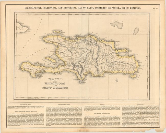
"Geographical, Statistical, and Historical Map of Hayti, Formerly Hispaniola or St. Domingo", Carey & Lea
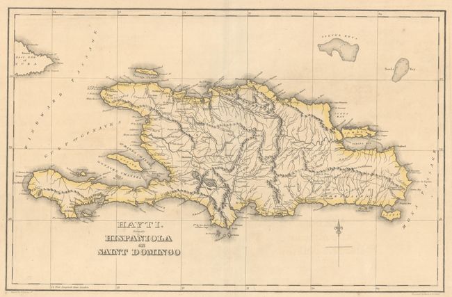
Subject: Hispaniola
Period: 1827 (circa)
Publication: A Complete Historical, Chronological, and Geographical American Atlas
Color: Hand Color
Size:
18.3 x 11.8 inches
46.5 x 30 cm
Download High Resolution Image
(or just click on image to launch the Zoom viewer)
(or just click on image to launch the Zoom viewer)
A detailed map of the island of Hispaniola providing an excellent view of its settlements, plantations, roads and harbors. English text at bottom describes the island's geography, climate, population and cities. Drawn by Fielding Lucas Jr. and engraved by Young & Delleker. On a full sheet of English text measuring 22.2 x 17.7".
References:
Condition: B+
A nice impression with contemporary outline color. There is light toning along the sheet edges and some minor chipping in the bottom blank margin.
Estimate: $110 - $140
Current High Bid:
$0
Reserve: Reserve Not Met
Next Bid: $55
Bid Increments
$50 - $99$5
$100 - $249$10
$250 - $499$25
$500 - $999$50
Terms & Conditions