Current Auction
"Mountains & Rivers", Johnson & Browning
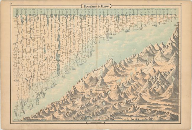
Subject: Cartographic Miscellany, Mountains & Rivers
Period: 1860 (circa)
Publication: Johnson's New Illustrated Family Atlas...
Color: Hand Color
Size:
23.9 x 16.8 inches
60.7 x 42.7 cm
Download High Resolution Image
(or just click on image to launch the Zoom viewer)
(or just click on image to launch the Zoom viewer)
J.H. Colton first issued this great double-page chart showing the major rivers and mountains of the world in 1855. The map is divided diagonally in an interesting composition. In the upper portion, scores of rivers are named and drawn to indicate their relative lengths. The lower half of the sheet features stylized renderings of the mountains organized by continent and drawn to indicate their relative heights. Volcanoes are shown erupting and major cities are shown at their respective elevations.
References:
Condition: B+
There is light toning along the centerfold and minor foxing.
Estimate: $120 - $150
Current High Bid:
$0
Reserve: Reserve Not Met
Next Bid: $60
Bid Increments
$50 - $99$5
$100 - $249$10
$250 - $499$25
$500 - $999$50
Terms & Conditions