Current Auction
Rare Charts with Excellent Detail of Amazon River and Rio de la Plata
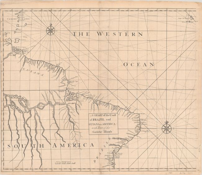
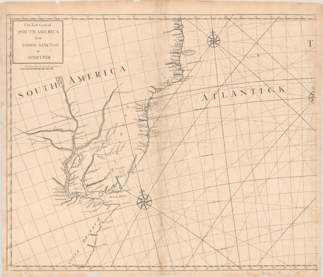
"[Lot of 2] A Chart of the Coast of Brazil and Guiana, in America: with Part of the Caribbe Islands [and] The East Coast of South America from Todos Sanctos to Sinifundi", Senex, John
Subject: Eastern South America
Period: 1728 (circa)
Publication: Atlas Maritimus & Commercialis…
Color: Black & White
Size:
23.5 x 19.6 inches
59.7 x 49.8 cm
Download High Resolution Image
(or just click on image to launch the Zoom viewer)
(or just click on image to launch the Zoom viewer)
This rare pair of maps depict the eastern coastline of South America from the Orinoco River in Venezuela to the Rio de la Plata between Uruguay and Argentina. The focus of the maps is on the extensive rivers systems of the Amazon, Parana, and the numerous smaller rivers all along the coast. A few early forts are also noted. These maps were published in Atlas Maritimus & Commercialis, an atlas with several joint publishers, among them James and John Knapton, William and John Innys, and John Senex. Senex is often credited with preparing the various charts therein. Most likely engraved by Samuel Parker, who is credited on other charts in the atlas. According to Shirley, the atlas is often catalogued under Astronomer-Royal Edmund Halley, who contributes an introductory note on the projection used throughout the atlas.
References: Shirley (BL Atlases) M.HALL-1a #45 & #46.
Condition: B+
Excellent impressions on lightly toned sheets with minor offsetting and an archivally repaired centerfold separation at the bottom of each sheet. There are a number of small chips and tears along the edges of the sheets, most of which have been repaired. The northern sheet has a very narrow left margin.
Estimate: $800 - $950
Current High Bid:
$0
Reserve: Reserve Not Met
Next Bid: $400
Bid Increments
$250 - $499$25
$500 - $999$50
$1,000 - $2,499$100
$2,500 - $4,999$250
Terms & Conditions